Getting to Know Northeast Iceland
The northeast of Iceland can be loosely divided into three peninsulas: Tjörnes, Melrakkaslétta (or "Slétta"), and Langanes. Renowned for their lonely seascapes and shorelines teeming with puffins and other seabirds, northeast Iceland is a treasure-trove of hidden and overlooked natural wonders.
Tjörnes

Ásbyrgi Canyon
Tjörnes is a great introduction to the wild and unspoiled northeast of Iceland, with isolated sea cliffs and panoramas of the Arctic Ocean. You’ll likely drive through it from Húsavik to Asbyrgi, but don’t forget to stop and admire the region’s geological prizes.
Húsavik

Húsavik is renowned as the whale-watching capital of Iceland, with daily boats out into the northern Atlantic, and an educational whale museum. The 9th-century Norseman Garðar Svavarsson wintered here while making the first recorded circumnavigation of Iceland. He built shelters here to survive the cold, lending Húsavík its name: the “Bay of Houses.”
Grenjaðarstaður Turf House

If you want to see how Icelanders lived for nearly a millennia, drop by the turf house at Grenjaðarstaður. Turf houses are simple wooden or stone structures with a roof made from turf and grass. They were typical in Iceland until the 19th century, when tin roofs became the norm. The homestead at Grenjaðarstaður dates back a thousand years, but the houses there are much younger with the oldest parts dating back to 1865. The house is now a converted museum, which tells the story of life in 19th-century Iceland, and is full of lovely old plates, kitchen utensils, teapots and other household items. Peek into the old church, Grenjaðarstaðakirkja, next door; it was erected in 1865, but bears an old pulpit painting and church bells that are much older. The turf house is typically open daily from June through August.
Laufás Turf House
The Laufás turf houses are very cute and picturesque historic houses in Eyjafjördur. Once a manor and wealthy vicarage, these houses are prettier than what was typical of the time. People have lived at Laufás since the 9th century, and there's been a church here as long as Christianity has been in Iceland. The present church at Laufás was built in 1865 and houses a gorgeous pulpit from 1698. Laufás is open in the summer months. To get there, drive an hour west of Husavik on Route 85, and onto the Ring Road. Turn right at Grenvikurvegur.
Fossils at Hallbjarnarstaðakambur
The large peninsula of Tjörnes rests in the northeast of Iceland, between the Skjálfandaflói gulf and Öxarfjörður. At Hallbjarnarstaðakambur beach, you can check out a real geological gem: huge layers of exposed fossilized seashells dating over 3 million years old. You can hike around the fossils, but note that it's strictly forbidden to disturb or remove anything on this protected land. To get there, drive from Husavik, continue onto Nordausturvegur Route 85, and turn toward the sign to Tunguvellir. Just a short drive from the main road is the seashore.
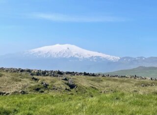
Dettifoss & Ásbyrgi Canyon

A view below Dettifoss along the Canyon (Photo by Chris McCarty)
The powerful Dettifoss waterfall and the magnificent Ásbyrgi Canyon nearby alone are worth the drive to the northeast of Iceland. Both are accessible from the Ring Road, or if you’re on Road 85 doing a tour of the northeast peninsulae, you can take the detour 864. There are many great hikes around both sites. You could easily spend a full day hiking in the canyon, but for a real exploration, you'll need 2-3 days. Dettifoss is known as the filming location for the film Prometheus, as is close hiking distance from two other beautiful waterfalls, Selfoss and Hafragilsfoss. Ásbyrgi Canyon rests in a nature reserve inside the Jokulsargljufur National Park. Make sure to stop by Hljóðaklettar, a cluster of basalt columns, where echoes have been known to bounce across the valley in a cascading cacophony.
Chat with a local specialist who can help organize your trip.
Melrakkaslétta

Melrakkaslétta is one of the most overlooked regions in all of Iceland, but its howling winds, lonely moors, and beaches full of driftwood make it a fascinating destination. To get there from Húsavík, drive eastward 60 miles (97 km) to Kópasker. If you’re coming from Egilsstadir or from Myvatn, drive the Ring Road to Dettifoss, turning at Road 85 and also at the junction of Road 870. From the junction, it’s 3 miles (5 km) to Kópasker.
West Melrakkaslétta
On the western edge of Melrakkaslétta is the village Kópasker with its Earthquake Center and nests of seabirds like the redpoll, great skua, and razorbill, along with the rare and elegant gyrfalcon. In northwest Melrakkaslétta, look for the isolated cape of Rauðinúpur, with its reddish ice age volcano, and an isolated lighthouse at Hraunhafnartangi.
Arctic Henge
The Arctic Henge project is a monument dedicated to Nordic heritage, erected in 1996. Inspired by the Eddic poem Völuspá, the artistic project is made of four triangular peaks, composed of 72 small blocks, each inscribed with a dwarven name. Visitors can view the midnight sun through the different vantage points. As of today, the piece is still a work in progress. To get there, drive through colorful and tiny Raufarhöfn Village on the Melrakkaslétta Peninsula.
Rauðanes Cape
Rauðanes is a beautiful inlet in Þistilfjörður in the northeast, at the end of the Melrakkaslétta Peninsula. Here you'll find some interesting geological formations: collapsed caves, natural arches, and rock stacks.
Rauðanes Point Cliff Hike

For a scenic walk along the coastline, hike out from the Raudanes parking lot to the cliffside. Follow the marked path, walking toward the cliffs and continue down a steep path along the cliffside. The whole hike is about 4 miles (7 km) long. The coast is rich with seabirds, including puffins in the summertime, and painted with heather moorland and rocky outcrops. Look out for Háabjarg, a 60-meter high cliff, the basalt bluffs of Lundastapar, the Gluggur stone bridge, and the Gatastakkur arch. After the arch, you’ll come across Stakkabásar beach, home to a small cave called Hannesarhellir, or Hannes’ cave. It’s so named because the name Hannes is carved on one of the cave’s walls, from a time long ago when sailors were stranded here, seeking shelter from a storm.
Langanes

Langanes is home to endless bird cliffs and birdwatching spots, and befittingly is shaped like a goose's head. Avian fans should look for the sea cliff of Skoruvikurbjarg in particular, where locals have built a viewing terrace that extends over the water for a unique vantage of the nesting sites.
Þórshöfn
The small township of Þórshöfn has thrived thanks to the fishing industry, with a bustling harbor and modest camping site. Stop by the Báran restaurant for an afternoon bite, to try the ocean quahog soup.
Heiðarfjall
At Heiðarfjall are some curious ruins, including the remains of an old NATO radar station from the Cold War, in operation from 1954 to 1968. There are many abandoned settlements nearby at Langanes, such as Skálar fishing village, Heiðarhöfn, Læknistaðir, Skoruvík, Fagranes and Saurbær. Stop by Sauðanes to take a look at the old church which has been converted into a museum, open from June to August.
Getting There
Most of the main sites in the three peninsulae follow the Road 85 from Húsavik to Thorshöfn. Keep on this road and you should be able to access the smaller routes to get a great overview of the sights. As with most areas in Iceland, maps can give an impression of short distances, when in fact the winding routes can result in a longer drive than anticipated. Husavik to Laufas, for instance, will take 1 hour, whereas Husavik to Ásbyrgi will take 45 minutes. Crossing both Tjörnes and Melrakkaslétta Peninsula will take you around 2.5 hours at the very least, not even counting the frequent stops.
Where to Stay
Tungulending Guesthouse
Tungulending Guesthouse is located on the coast of Skjálfandi Bay, near Húsavik and close to the fossil cliffs. Once an old caviar factory, it's been carefully renovated and refurbished. The location is amazing on the shoreline, but a bit tricky to get to as it’s about 5 minutes off the main road and can be a steep drive in places down to the water. Rooms are clean, with beds right next to the shore so you can gaze straight out onto the water or listen to the waves crash gently on the rocks as you fall asleep. Dinner is often a fresh fish prepared daily, and they also have a bar area that serves beer and wine. This property comes highly recommended by our local specialists.
Ytra Lóni Farm Hostel
The warm and welcoming Ytra Lóni Farm Hostel in Þórshöfn makes a fitting rest stop at the end of your northeast journey. The hostel offers a barbecue, hot tub, bar, terrace and free private parking. In the summer, guests can visit the stables of the onsite sheep farm. Staying at this farmhouse is more like visiting an intimate country cottage than a hotel.
Map