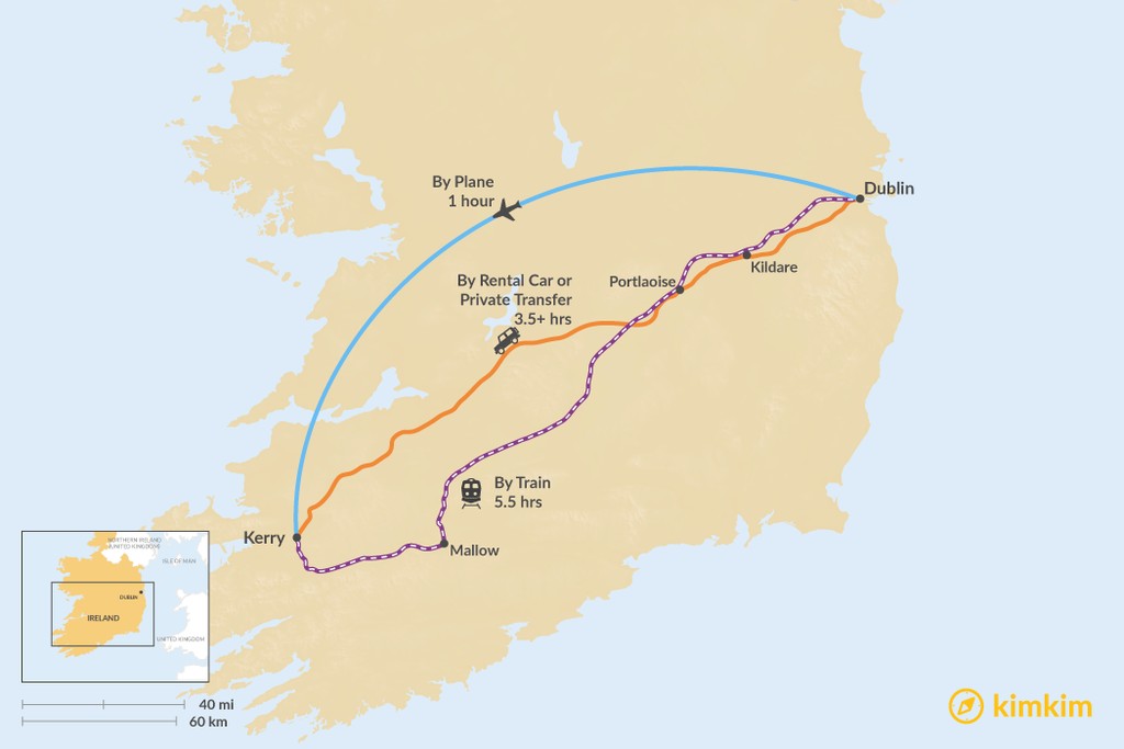
The distance from Dublin to County Kerry is about 192 miles (304 km). The most comfortable way to get from one to the other is by plane which only takes an hour but there are numerous other ways to get there. Some might opt to drive the 3.5 hours to enjoy the views along the way.
To fully immerse yourself in County Kerry's natural beauty, consider this 8-day walking itinerary of the Kerry Peninsula. Start in Killarney, walking through Kenmare, Sneem, and Caherdaniel. Veer west through Waterville and Cahersiveen to your final village in Glenbeigh.
By Plane
Duration: 1 hour
Aer Lingus has two flights a day leaving from DUB and arriving at KIR.
By Private Transfer or Rental Car
Duration: 3.5 hours, more with stops
Private drivers are easily found in Dublin but you can also rent your own car. Beware of narrow country roads and passing sheep—a smaller rental car is your best bet.
Getting from Dublin to County Kerry takes about a little more than 3.5 hours along highways M7 and N21. The coast to coast route from Dublin to County Kerry is very scenic, as you will be driving through verdant green countryside and farmland.
Consider a stop in Limerick to see the Thomond Bridge and King John's Castle on the River Shannon. Make sure to try Limerick ham before you go—developed in the town of Limerick, this is a ham that is smoked over juniper branches, cured, boiled in hard cider, and then baked to crisp it.
Once you've had your fill, hop back on M7 to merge onto N21 to continue to your destination.
By Train
Duration: 5.5 hours
While a train ride might be a nice way to take in the views without having to drive yourself, it does take 5.5 hours and there is a transfer. Run by Irish Rail, it departs every few hours and it's recommended to buy your tickets ahead of time. There are some overnight runs that might be of interest so you can catch some zzzs before exploring Kerry.


