How to Get from Dublin to the Cliffs of Moher
The renowned Cliffs of Moher are located 166 miles (267 km) from Dublin. The best way to make the journey between the two is by car, either self-driving or with a private... read more
The renowned Cliffs of Moher are located 166 miles (267 km) from Dublin. The best way to make the journey between the two is by car, either self-driving or with a private... read more
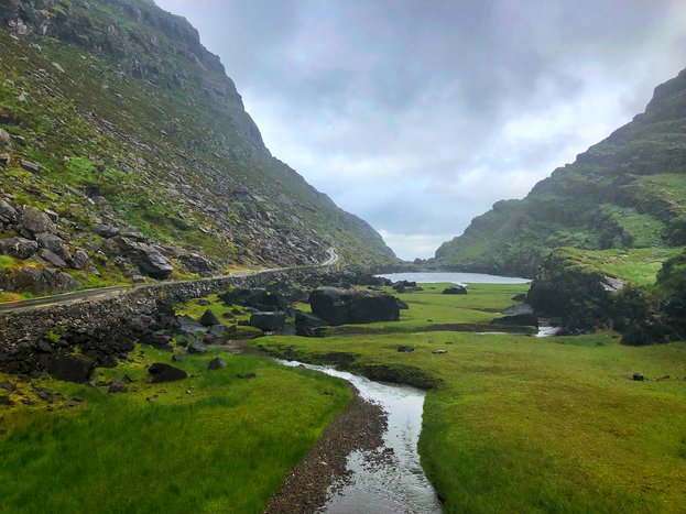
Killarney—the scenic gateway to Killarney National Park—is 191 miles (307 km) southwest of Dublin. The fastest way to make the journey is by train. With just one connection in... read more
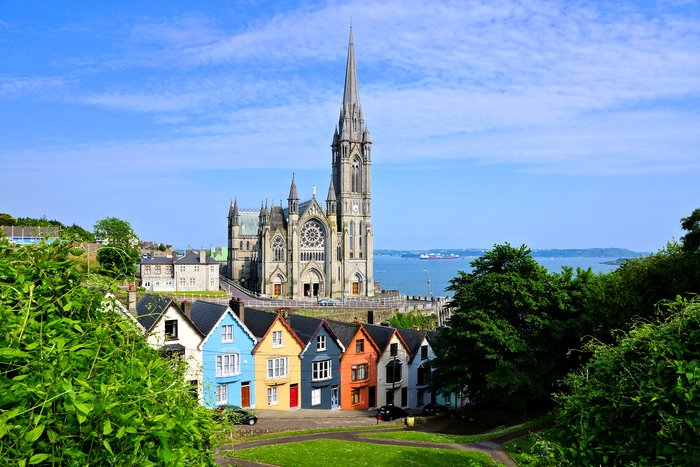
The city of Cork—Ireland’s southern hub—is 161 miles (259 km) from Dublin. The fastest way to travel between the two is by train, which offers many direct departures and takes... read more
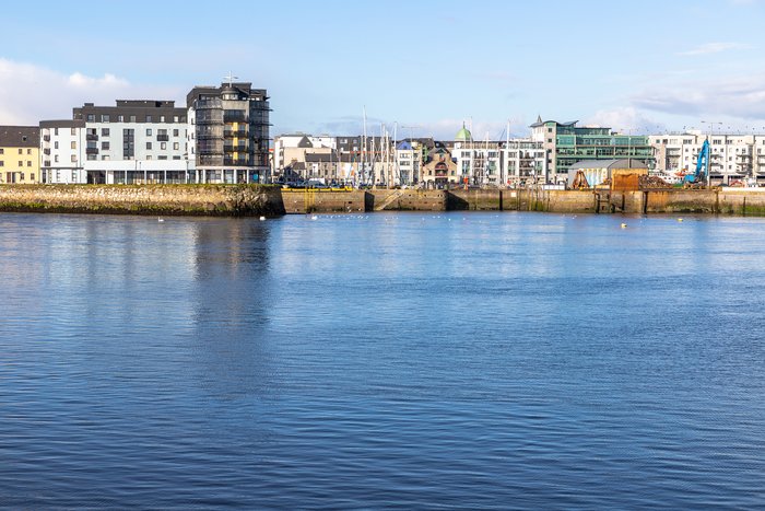
Galway, Ireland’s popular western hub, is 202 miles (325 km) from Belfast. Despite the distance, it’s fairly easy to visit the two cities within the same trip. The fastest and... read more
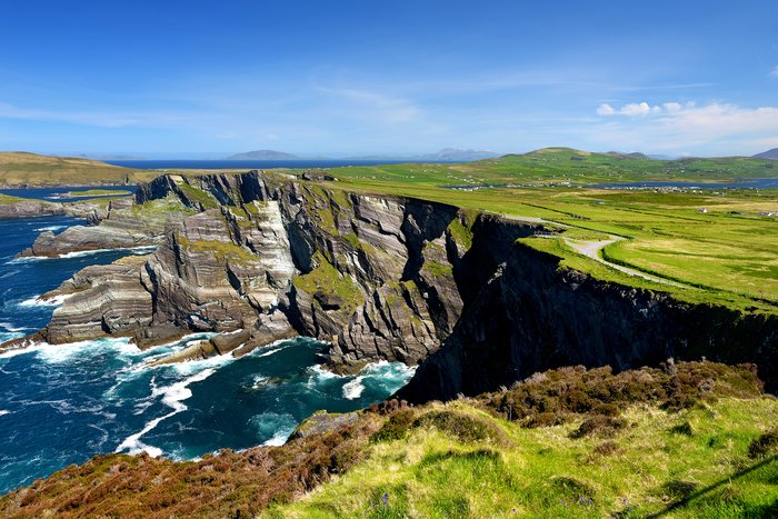
The distance from Dublin to County Kerry is about 192 miles (304 km). The most comfortable way to get from one to the other is by plane which only takes an hour but there are... read more
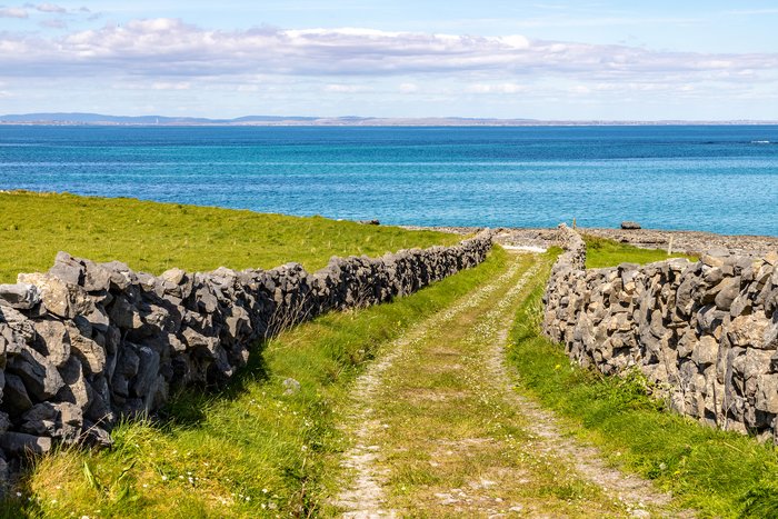
The Aran Islands—three rocky, windswept islands set of the west coast of Ireland—are 30 miles (47 km) from the city of Galway. The closest island is Inis Mór (Inishmore), which... read more
The riverside medieval city of Kilkenny is just 80 miles (129 km) from Dublin, and the route between the two is quick and easy. The most convenient way to make the journey is by... read more
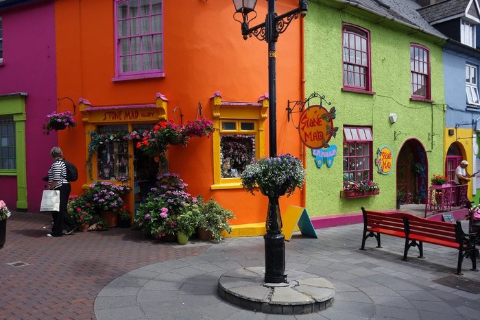
Set near the southern coast of Ireland, the colorful harbor town of Kinsale is 176 miles (284 km) from Dublin. Mostly connected by major highways, the most convenient way to... read more
The small seaside town of Doolin—famous for its traditional music scene—is just 44 miles (71 km) from Galway. The fastest and most convenient way to travel between the two is by... read more
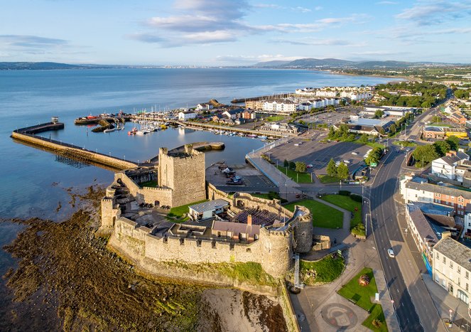
Belfast is just 103 miles (166 km) north of Dublin. The two capitals are connected by major highways, so making the journey is quick and easy. Whether you opt to go by car,... read more
The seaside retreat of Dingle Town is set 212 miles (341 km) directly southwest of Dublin. At 4.5 hours, the fastest and most convenient way to make the journey is by rental car... read more
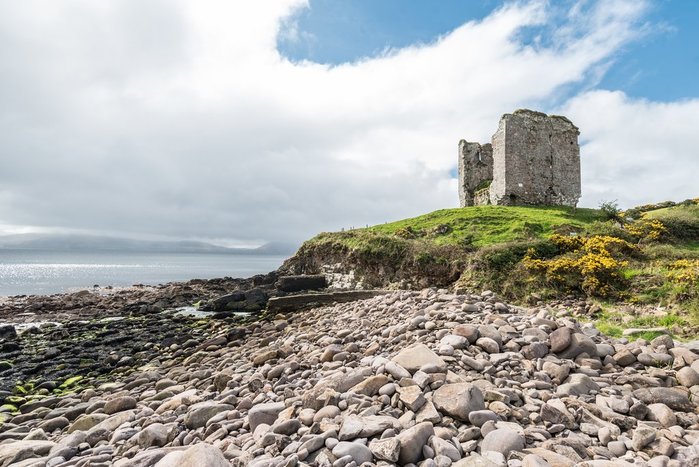
The distance from Dublin to County Clare is about 147 miles (237 km). The most comfortable way to get from one to the other is by private transfer or rental car as it's a... read more
The Ring of Kerry, a scenic drive around Ireland’s Iveragh Peninsula, is 191 miles (308 km) southwest of Dublin. The most convenient way to make the journey is by car, either... read more
Despite being set on opposite sides of the country, Dublin is just 129 miles (208 km) from Galway. And because they’re connected by a main highway, visiting the two cities on... read more
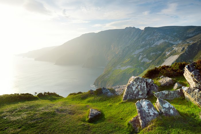
The scenic county of Donegal sits in Ireland’s rural, northwest region. Many who visit the Irish-speaking area use Letterkenny as a hub, which is 155 miles (249 km) from the... read more
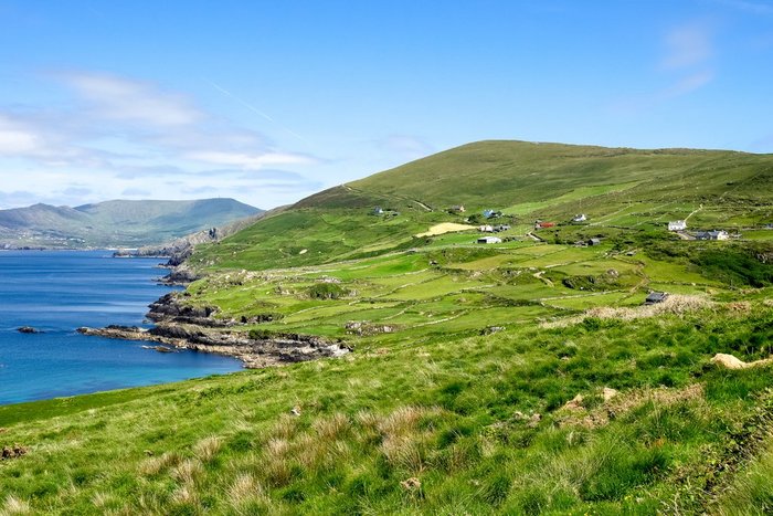
The scenic region of Connemara sits north and west of Galway. Many who visit the coveted, Gaelic-speaking area use Clifden as a hub, which is 49 miles (77 km) from the city of... read more
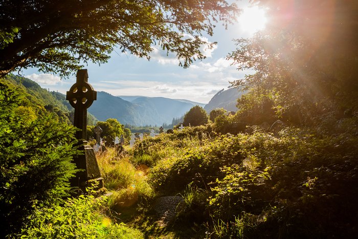
The distance from Dubin to Glendalough is only about 30 miles (48 km). Glendalough is a glacial valley in Wicklow County known for its natural beauty and monastic sites. The... read more
Kinsale, a colorful harbor town known for its foodie scene, is just 17 miles (27 km) south of Cork. The fastest way to make the journey is by car—rental or private transfer—in... read more
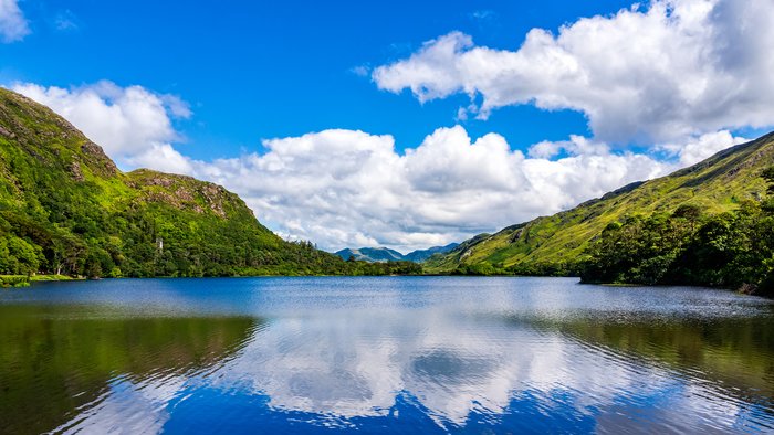
Killarney National Park—set along the scenic Ring of Kerry—is a popular tourist attraction in the southwest of Ireland. Its 25,000 acres encompass lakes, forests, bogs, and... read more
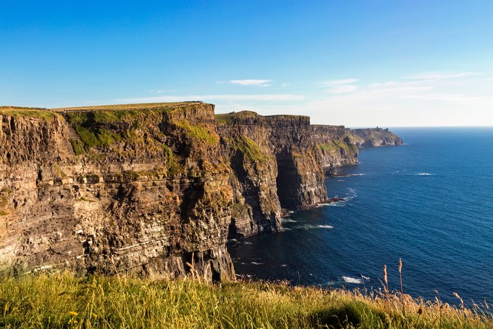
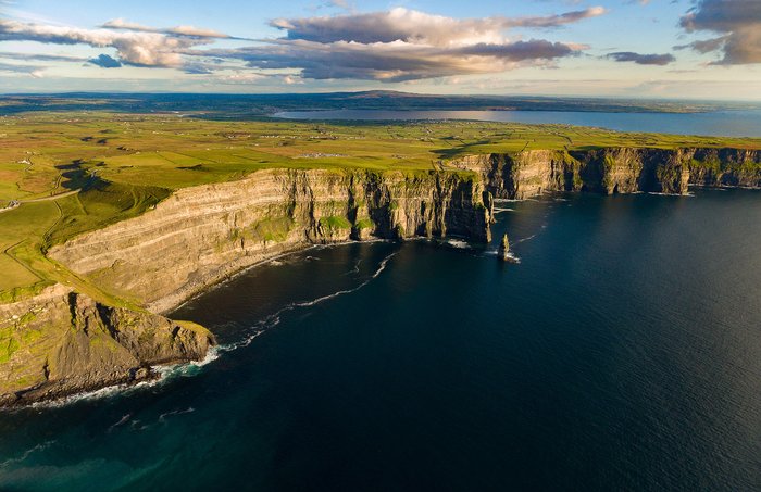
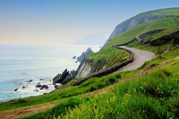
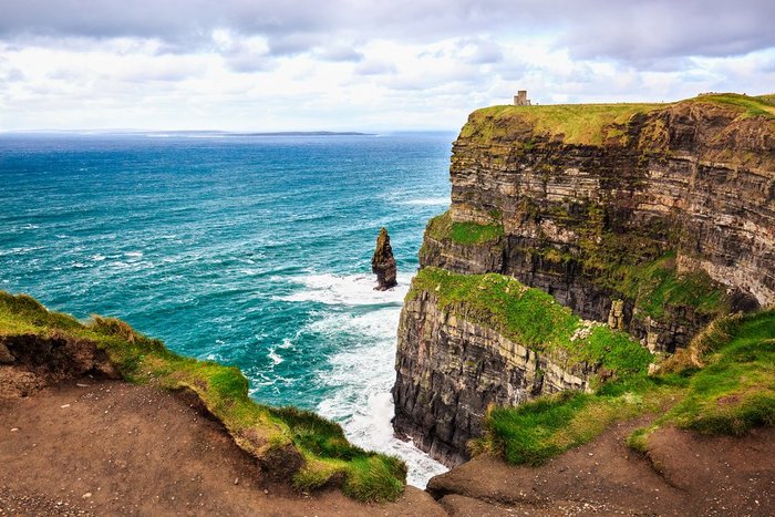
Set near the small town of Doolin on the west coast of Ireland, the Cliffs of Moher—famous, rocky sea cliffs rising above 700 feet—are home to 20 different bird species and... read more
The distance from County Cork to County Kerry is about 72 miles (101 km). The most comfortable way to get from one place to the other is to drive or use a private transfer. The... read more
Set in the southwest of Ireland, the Ring of Kerry is a scenic drive encompassing the Iveragh Peninsula. The route is 111 miles (172 km) and passes through numerous villages... read more
The Dingle Peninsula—one of Ireland’s most scenic regions—is 213 miles (342 km) southwest of Dublin. The most convenient and fastest way to make the journey between the two is... read more
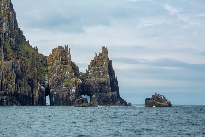
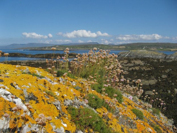
The Aran Islands sit at the mouth of Galway Bay on Ireland’s scenic west coast. The three islands—named by size and location as Inis Mór (Inishmore), Inis Meáin (Inis Maan), and... read more
Londonderry (Derry) is just 70 miles from Northern Ireland’s capital, Belfast. You can easily visit both cities on the same trip thanks to the extensive network of highways,... read more
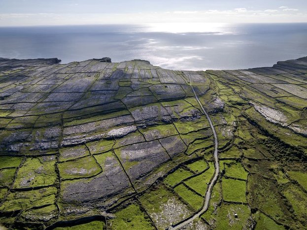
County Clare—famous for its dramatic coastlines and lively music scene—is one of Galway’s neighboring counties. The small city of Ennis serves as its capital and transportation... read more
The distance from County Cork to County Clare is about 80 miles (129 km). The most comfortable way to get from one to the other is by private transfer or rental car as it's a... read more
The Dingle Peninsula—one of Ireland’s most scenic regions—sits on the southwest coast in County Kerry. The peninsula’s transportation hub, and a good place to start your visit,... read more
The Beara Peninsula is a scenic, mountainous region set in the southwest of Ireland. Two towns act as tourist hubs for the peninsula: Kenmare to the north and Bantry to the... read more
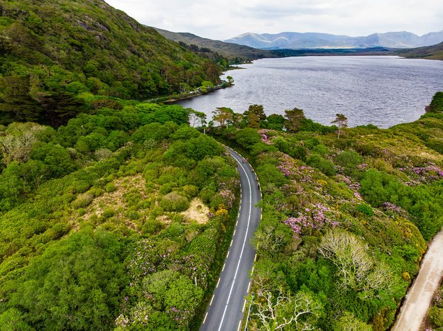
Connemara in County Galway, on the west coast of Ireland, is a remote and wild corner of the Éire. Speckled along the rugged Atlantic coastline are the islands of Connemara—only... read more