Highlights
- Hike up to the famed Tiger's Nest Temple
- Complete one of the most challenging treks in the world
- Run into wild takins, the Bhutanese national animal
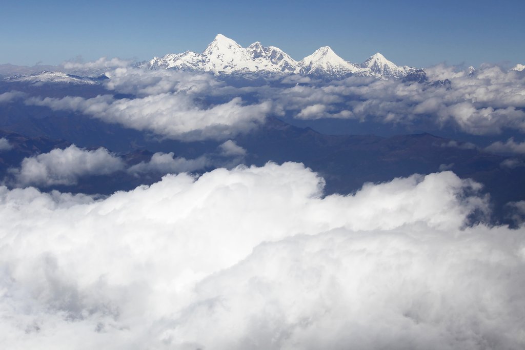
- See Mt. Jomolhari, Bhutan's most sacred mountain
- Experience life in rural Bhutan
Brief Itinerary
| Day | Highlights | Overnight |
|---|---|---|
| Day 1 | Arrive in Paro | Paro |
| Day 2 | Paro Sightseeing | Paro |
| Day 3 | Hike to Tiger's Nest | Ha |
| Day 4 | Sharna Zampa to Thangthangkha | Jigme Dorji National Park |
| Day 5 | Thangthangkha to Jangothang | Jangothang |
| Day 6 | Rest Day in Jangothang | Jangothang |
| Day 7 | Jangothang to Lingshi | Lingshi |
| Day 8 | Lingshi to Chebisa | Chebisa |
| Day 9 | Chebisa to Shomuthang | Chebisa |
| Day 10 | Shomuthang to Robluthang | Gasa |
| Day 11 | Robluthang to Limithang | Gasa |
| Day 12 | Limithang to Laya | Laya |
| Day 13 | Rest Day in Laya | Laya |
| Day 14 | Laya to Rhoduphu | Laya |
| Day 15 | Rhoduphu to Narethang | Laya |
| Day 16 | Narethang to Tarina | Tang |
| Day 17 | Tarina to Woche | Tang |
| Day 18 | Woche to Lhedi | Tang |
| Day 19 | Lhedi to Thanza | Tang |
| Day 20 | Rest Day in Thanza | Tang |
| Day 21 | Thanza to Danji | Trongsa |
| Day 22 | Danji to Tshochena | Trongsa |
| Day 23 | Tshochena to Jichu Dramo | Trongsa |
| Day 24 | Jichu Dramo to Chukarpo | Trongsa |
| Day 25 | Chukarpo to Thampe Tsho | Trongsa |
| Day 26 | Thampe Tsho to Maurothang | Trongsa |
| Day 27 | Maurothang to Sephu | Trongsa |
| Day 28 | Flight to Paro | Paro |
| Day 29 | Rest Day in Paro or Thimphu Day Tour | Paro |
| Day 30 | Depart from Paro |
Detailed Itinerary
Day 1: Arrive in Paro

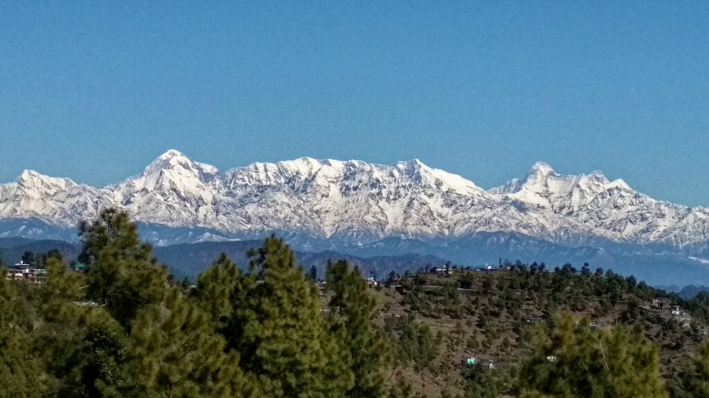
Welcome to Bhutan! The Paro valley is a perfect entry into this world, with its pure air purity and absorbing serenity. Paro retains its bucolic nature despite the existence of development projects. Fields of brown or green cover most of the valley floor while hamlets and isolated farms dot the landscape.
Your Bhutanese guide will meet you outside the customs enclosure and escort you to your accommodation hotel. You can spend the rest of the day walking around Paro town and taking in the scenery.
Day 2: Paro Sightseeing

Today, you will explore quaint Paro and its surroundings:
Paro Dzong
Also called Rinpung Dzong, the Fortress of a Heap of Jewels, this fortress-monastery is one of the kingdom’s most excellent examples of traditional Bhutanese architecture. Today, the dzong houses a monastic school, with two hundred resident monks taking meals in a communal room. There are several interesting paintings here, including an unusual Bhutanese interpretation of a mandala, a diagram of the cosmos.
As you hop back into your transport, you will cross the traditional wooden covered bridge called Nyamai-Zam, which spans the Paro River.
Kyichu Monastery
This is one of the oldest monasteries in the country, having been built in the 7th century. According to legend, a giant demoness lay across the whole area of Tibet and the Himalayas and prevented the spread of Buddhism. The temple was erected on her left foot—as one of more than a hundred—to help its light overcome her power. Visitors today can still offer butter lamps as a symbol of removing the darkness of ignorance to attain Buddha's luminous clear wisdom.
Drugyel Dzong Ruins
One of the four principal Dra Dzongs (defense fortress), this dzong was built to commemorate the victory of the Bhutanese over the allied Tibet-Mongol forces. Hence its name Druk Gyal “the fortress of victory." In 1951, the dzong was burnt when a butter lamp fell in the central tower. However, you can still see the ruins and learn about its history.
Optional:
Drakharpo Monastery
After breakfast, you will begin a 60-minute hike to the monastery, which has a small community of monks living nearby. The main temple room is precariously perched on the edge of a rocky cliff. There are some sacred sites to view, including the body imprint of Vajrayogini and a stone boot belonging to Guru Rinpoche. The monastery is built on a mountain dotted with underground caves.
Day 3: Hike to Tiger's Nest

After breakfast, you'll hike to view one of the most revered pilgrimage sites in the Buddhist world, the Taktshang Lhakhang, popularly known as the Tiger’s Nest Monastery. The trek offers spectacular views of this sacred monastery perched precariously on a sheer rock face 10,236 feet (3,120 m) above the valley floor. Legend has it that Guru Rimpoche, father of Bhutan’s stream of Mahayana Buddhism, arrived in the Paro valley more than a millennium ago on the back of a tigress. He meditated for three months in a cave, which became this monastery.
You'll begin the hike from the base to the cafeteria, which will take at least an hour and a half. From here, it’s about an hour’s trek through some stunning landscape to reach the monastery. After trekking down from the temple, you'll drive to the Chele La pass. On clear days, you can see Mount Chomolhari. The Ha valley is a beautiful area adorned with pristine alpine forests and remains one of the least visited regions in the country. The valley offers a wonderful scenic walk along trails passing through picturesque villages and magnificent monasteries.
Hiking duration: Approximately 2-3 hours ascent, and 2 hours descent
Difficulty: Easy to moderate
Note: Ponies are available for ascension at an additional cost.
Day 4: Sharna Zampa to Thangthangkha

On this long day, you'll trek through a volatile terrain. You'll pass through Jigme Dorji National Park. After going uphill through the river valley, the trail gradually narrows to a small path that descends to a meadow. Here, you'll finally rest your feet and set up camp.
If weather permits, you will have the first great view of Mt. Jomolhari.
Hiking distance: 14 miles (22 km)
Hiking duration: 7-8 hours
Ascent: 2,526 feet (770 m), Descent: 33 feet (10 m)
Camp altitude: 11,844 feet (3,610 m)
Day 5: Thangthangkha to Jangothang

The trek continues up the Paro Chhu valley, which widens into patches of alpine meadow and scanty growths of forest. You will cross an army checkpoint along the way and enjoy a spectacular view of high mountain ridges and snow-capped peaks. In this area, yaks and their herder’s homes become a regular feature. Passing the villages Soe, Takethang, and Dangochang is another asset on this day. After reaching Jangothang, one of the most beautiful campsites of the Himalayas, you will again have a spectacular view of Mt. Jomolhari, Bhutan's most sacred mountain.
Hiking distance: 12 miles (19 km)
Hiking time: 5-6 hours
Ascent: 1,575 feet (480 m)
Camp altitude:13,385 feet (4,080 m)
Day 6: Rest Day in Jangothang

You can spend this low-key free day as you wish. If you don't want to lose momentum, there are plenty of hikes in Jangothang. You'll have great views of lakes and snow-capped mountains such as Jomolhari and Jichu Drake. Be on the lookout for blue sheep on the upper slopes of the valley.
You can also trek up to Tosoh or hike around the area. There are good short hiking trails in three directions: Jomolhari and its subsidiary mountain chains to the west, Jichu Drake to the north, and several unclimbed peaks to the east.
Day 7: Jangothang to Lingshi

Today is one of the longest days of the trek. A short distance from the camp, the trail begins climbing rapidly for about half an hour and then becomes a gradual ascent to the Nyilila Pass at 15,978 feet (4,870 m).
While on the climb, you can enjoy the surroundings. You might see herds of blue sheep grazing on the slopes of the mountains. From the pass, you will have spectacular views of Mt. Jomolhari, Jichu Drake, and Tsherimgang. From here, it's a gradual descent to the camp, where you will pass by some yak herder’s tents made from yak wool. The herders use these tents while traveling to various pastures with their yaks.
As you come down into the Lingshi basin, a beautiful U-shaped valley, you may get a magnificent view of Lingshi Dzong. The campsite is next to a quaint stone hut.
Hiking distance: 11 miles (18 km)
Hiking duration: 6-7 hours
Ascent: 2,756 feet (840 m), Descent: 2,854 feet (870 m)
Camp altitude: 13,156 feet (4,010 m)
Day 8: Lingshi to Chebisa

Take it easy on the shortest walking day of the trek. Shortly after starting, you will reach a stupa below Lingshi Dzong. Here, you have the choice of staying on the main trail or taking a detour up to Lingshi Dzong (4,220m), which sits right atop a high ridge. This dzong is under reconstruction from a 2011 earthquake that damaged its central building. In addition to an atmosphere of spiritual tranquility, Lingshi Dzong provides a great view over the valley. Afterward, you will be passing the villages of Lingshi and Goyul.
Upon reaching the campsite at Chebisa, you will have plenty of time to visit the village if you feel up to it. There is also a beautiful waterfall located behind the village that is worth visiting.
Hiking distance: 6 miles (10 km)
Hiking duration: 5-6 hours
Ascent: 918 feet (280 m), Descent: 1,345 feet (410 m)
Camp altitude: 12,730 feet (3,880 m)
Day 9: Chebisa to Shomuthang

The morning starts with a long ascent behind Chebisa Village (2-3 hours) through a wide pastureland towards Gobu La (pass). On the way, you will see a few people herding yaks.
After crossing Gobu La, you descend into the valley, then climb before descending once again to Shakshepasa, a large U-shaped valley. Climbing from here will take you to the campsite at Shomuthang.
Hiking distance: 11 miles (17 km)
Hiking duration: 6-7 hours
Ascent: 2,920 feet (890 m), Descent: 1,772 feet (540 m)
Camp altitude: 13,845 feet (4,220 m)
Day 10: Shomuthang to Robluthang

Begin the day by climbing up the valley to view Kang Bum. After two hours of climbing, you will reach Jhari La, from where you catch the first glimpse of Sinche La, the pass you will have to cross the day after. The big snow peak in the north is Gangchhenta, better known as the Great Tiger Mountain.
If the weather is clear, Tserim Kang and the top of Jomolhari will be visible. The camp by the river is called Tsheri Jathang and is located in a vast and remote valley. Herds of takin, the Bhutanese national animal, migrate to this valley in the summer and remain for about four months. The valley has been declared a takin sanctuary. Climb up a bit more to reach the campsite at Robluthang in a rocky meadow.
Hiking distance: 11 miles (18 km)
Hiking duration: 6-7 hours
Ascent: 2,297 feet (700 m), Descent: 2,493 feet (760 m)
Camp altitude: 13,648 feet (4,160 m)
Chat with a local specialist who can help organize your trip.
Day 11: Robluthang to Limithang

The trek starts with an initial 40-60 mins ascent before gradually climbing for another 1.5 hours through a boulder field. There is then a steep hour ascent before reaching Sinche La. As you descend the far side of the pass, you will see an impressive terminal moraine and a glacial lake at the foot of the valley. You can see classic examples of lateral moraines where the glacier has pushed rocks up both sides of the valley. Below the moraine, you cross the Kango Chhu and soon reach the Limithang campsite.
Hiking distance: 12 miles (19 km)
Hiking duration: 6-7 hours
Ascent: 2,789 feet (850 m), Descent: 2,854 feet (870 m)
Camp altitude: 13,583 feet (4,140 m)
Day 12: Limithang to Laya

Today, you walk downhill along a narrow, winding river valley. After a long time, the trail takes you through a densely forested region. The trail leads you to the west side of Laya Village. From the west of the village, you will have spectacular views of Mt. Gangchhenta and Mt. Masagang. The village center has a community school and a basic health unit with a telephone connection.
Hiking distance: 6 miles (10 km)
Hiking duration: 4-5 hours
Ascent: 197 feet (60 m), Descent:1,115 feet (340 m)
Camp altitude: 12,598 feet (3,840 m)
Day 13: Rest Day in Laya

Spend the day resting from the trek and preparing yourself for the rest of this challenging but spectacular adventure. This rest day also allows you to let your body acclimatize to the altitude. You'll have a chance to meet friendly locals and enjoy Laya's beauty.
Day 14: Laya to Rhoduphu
From Laya, descend to an army camp and continue following the river until the turn-off point to Rhoduphu. After lunch, the climb continues through rhododendron bushes to the camp at Roduphu, right next to the Rhodu Chhu.
Hiking distance: 12 miles (19 km)
Hiking duration: 6-8 hours
Ascent: 3,379 feet (1,030 m), Descent: 2,460 feet (750 m)
Camp altitude: 13,648 feet (4,160 m)
Day 15: Rhoduphu to Narethang

After following the river for about half an hour, you will have a steady climb to a high open valley at 15,092ft (4,600m) and then further up to Tsomo La at 16,076 feet (4,900 m). Tsomo La offers a superb view of Lunana, Mount Jomolhari, Jichu Drake, and the Tibetan border. The route then crosses a flat, barren plateau until you get to the campsite at Narethang, which is towered by the peak of Gangla Karchung.
Hiking distance: 11 miles (17 km)
Hiking duration: 5-6 hours
Ascent: 2,428 feet (740 m)
Camp altitude: 16,076 feet (4,900 m)
Day 16: Narethang to Tarina

From the camp, you will climb for about an hour to Gangla Karchung La. The view from the pass is breathtaking, and the whole range of mountains, including Jekangphu Gang, Tsenda Kang, and Teri Gang, can be seen. The pass descends along a large moraine. Again one has great views: a massive glacier descends from Teri Kang to a deep turquoise lake at its foot. Finally, you have a very long descent through thick rhododendron to Tarina valley, where you will find several good campsites along the Tang Chhu River.
Hiking distance: 11 miles (18 km)
Hiking duration: 5-6 hours
Ascent: 886 feet (270 m), Descent: 3,937 feet (1,200 m)
Camp altitude: 13,025 feet (3,970 m)
Day 17: Tarina to Woche

The walk leads down through conifer forests, following the upper ridges of Pho Chhu, passing some impressive waterfalls. The trail then climbs over a ridge and drops to Woche, a settlement of a few houses and the first village in the Lunana region.
Hiking distance: 11 miles (17 km)
Hiking duration: 6-7 hours
Ascent: 886 feet (270 m), Descent: 1,083 feet (330 m)
Camp altitude: 12,828 feet (3,910 m)
Day 18: Woche to Lhedi

Today's trek starts through juniper and fir forests and, further ahead, through rhododendron bushes. Climb up to Keche La pass, where one can view the surrounding mountains again. After the pass, descend to the riverside walking through a village with a stunning view of Table Mountain. Follow up the river to Lhedi Village, which has a basic health unit, a school, and a wireless telephone connection.
Hiking distance: 11 miles (17 km)
Hiking duration: 6-7 hours
Ascent: 3,215 feet (980 m), Descent: 1,904 feet (1,190 m)
Camp altitude: 12,139 feet (3,700 m)
Day 19: Lhedi to Thanza

Continue the trek through the morning. Around lunchtime, you will pass the small village of Chozo, which has a dzong that is still in use. Once you reach Thanza, you will have a great view of Table Mountain, forming a 9,842ft (3,000m) high wall of snow and ice behind the village. Although there are possibilities to camp directly at Thanza, most groups prefer to camp in Thoencha.
Hiking distance: 11 miles (17 km)
Hiking duration: 7-8 hours
Ascent: 1,476 feet (450 m)
Camp altitude: 13,615 feet (4,150 m)
Day 20: Rest Day in Thanza

Take the day off to walk around and experience village life, or climb up the ridge for fascinating views of lakes and mountains. Today is an opportunity to recharge your energy and let your body have some much-needed rest.
You will also have to say goodbye to your trusty yaks and get new ones.
Day 21: Thanza to Danji

From Thoencha, the trail climbs up to a large boulder from where you will have excellent views of Thanza, Toencha, and Choso villages, as well as the surrounding mountains. After a few hours of relatively flat and easy walking, you will reach a yak meadow with some yak herders’ huts. You'll then continue to Sephu (Trongsa) for the night.
Hiking distance: 5 miles (8 km)
Hiking duration: 3-4 hours
Ascent: 262 feet (80 m)
Camp altitude: 13,878 feet (4,230 m)
Day 22: Danji to Tshochena

Having chosen the route to Sephu, the trek crosses the creek. After a long climb, you will reach Jaze La with spectacular panoramic mountain views. The path then descends between snow-covered peaks and a couple of small lakes to the campsite near the shore of Tshochena Lake.
Hiking distance: 7 miles (12 km)
Hiking duration: 5-6 hours
Ascent: 3,215 feet (980 m), Descent: 787 feet (240 m)
Camp altitude: 16,306 feet (4,970 m)
Day 23: Tshochena to Jichu Dramo

Follow the bank of the blue-green lake before arriving at a ridge at 16,732ft (5,100m). After going up and down over small hills to reach a glacial lake, the route descends before climbing again up the next pass, the Loju La. Finally, after crossing a small saddle, you will enter a wide glacial valley from where the trail descends gradually to the campsite at Jichu Dramo.
Hiking distance: 9 miles (14 km)
Hiking duration: 4-5 hours
Ascent: 755 feet (230 m), Descent: 492 feet (150 m)
Camp altitude: 16,568 feet (5,050 m)
Day 24: Jichu Dramo to Chukarpo

Right after leaving the camp, you will climb through a moraine to Rinchen Zoe La. The spectacular mountain scenery is the reward for climbing the highest pass on this trek route. Rinchen Zoe Peak towers above the pass at 18,537 feet (5,650 m). After you descend from the pass, the route leads into a wide valley with several lakes and goes steeply down along a moraine to the Thamphe Chhu. Here, the vegetation begins to thicken again, and you will see the first real trees since Lhedi. After a couple of hours, you'll reach the campsite at Chukarpo.
Hiking distance: 11 miles (18 km)
Hiking duration: 5-6 hours
Ascent: 1,050 feet (320 m), Descent: 2,395 feet (730 m)
Camp altitude: 15,092 feet (4,600 m)
Day 25: Chukarpo to Thampe Tsho

The descent continues along the river until you reach the yak herder huts at Gala Pang Chhu. From here, the trail climbs steeply toward Thampe Tsho, a beautiful clear turquoise lake with a campsite next to it.
Hiking distance: 11 miles (18 km)
Hiking duration: 5-6 hours
Ascent: 1,312 feet (400 m), Descent: 2,297 feet (700 m)
Camp altitude: 14,108 feet (4,300 m)
Day 26: Thampe Tsho to Maurothang

From the lake, you'll climb steeply to the last pass on your trek, the Thampe La. Then, the path descends to the sacred lake Om Thso. Passing a waterfall, you will reach another smaller lake and begin a steep descent to the Nikka Chhu. The path finally leads through a mixed forest to a large clearing on the banks of the river with a few yak herder huts, Maurothang.
Hiking distance: 9 miles (14 km)
Hiking duration: 5 hours
Ascent: 1,083 feet (330 m), Descent: 3,346 feet (1,020 m)
Camp altitude:11,844 feet (3,610 m)
Day 27: Maurothang to Sephu

On the last day of this extraordinary trek, your porters will have to change from yaks to horses as the yaks will not be willing to go further down. The path follows the Nikka Chhu River to reach a large grassy area overlooking the road and the village of Sephu. You finally reach the road at the Nikka Chhu bridge to Sephu, where you will find several stores selling bamboo products, as well as small restaurants
Day 28: Flight to Paro

Now that you've conquered the arduous trek, it is time to go back to Paro. You'll drive from Trongsa to Bumthang, where you will board a 2-hour flight to Paro.
Once in Paro, take time to rest and celebrate your victory.
Day 29: Rest Day in Paro or Thimphu Day Tour

Depending on how you feel, you can choose to have a peaceful rest day in Paro or go on a day tour to Thimphu.
If you choose the latter, you will visit:
Folk Heritage Museum
The Folk Heritage Museum gives you a glimpse of the traditional Bhutanese lifestyle. In addition to artifacts from rural households, it displays an impressive collection of traditional household objects, tools, and equipment. The museum also organizes regular demonstrations of rural traditions, skills, and customs, and hosts educational programs for children.
Royal Textile Museum
The Royal Textile Academy is the place to learn about Bhutan's living national art of thagzo (weaving). The ground floor focuses on royal ghos, including the wedding clothes worn by the fourth king and his four wives. The upper level introduces weaving techniques, styles of local dress, and type of textiles made by women and men. The museum shop offers some books and fine textiles.
Institute of 13 Arts and Crafts of Bhutan
This institute opened in June 1997 and reflects Bhutan’s effort to provide opportunities for vocational training. It is especially significant for this region, which has always been big on bamboo and wood crafts.
School of Astrology
Pangri Zampa Lhakhang is one of the gems of the region. Bhutanese parents also visit this Lhakhang for getting auspicious names and blessings for their newborns. Built in the 16th century, Lhakhang consists of two temples that will be visible as soon as you enter the compound. Giant stone walls painted with white will make you look to the top. As you raise your eyes from the prayer wheels at the entrance to the heights of the large temple walls, you will be stunned to see the beautiful combination of sheer scale and simplicity.
Post Office
Hard-core philatelists might be interested in this new museum, attached to the post office. Five galleries trace the development of the Bhutanese postal system, from the earliest mail runners to Bhutan's idiosyncratic and highly collectible modern stamps. Most importantly, you can get your photo printed in a Bhutanese Stamp.
Tashichho-Dzong
Also known as the "Fortress of the Glorious Religion," it was initially built in 1641 and later rebuilt in its present form by King Jigme Dorji Wangchuk in 1965. The Dzong houses the main secretariat building with the Throne Room of His Majesty, the King of Bhutan. The National Assembly Hall is housed in a modern building on the other side of the river. During the warmer summer months, the monk body headed by His Holiness the Je Khenpo resides in the dzong.
Day 30: Depart from Paro

It is time to leave the Kingdom of Bhutan behind, taking with you memories of one of the world's most challenging and rewarding treks. Tashi Delek! Hope you will visit us again!
More Great Bhutan Itineraries
Looking for more inspiration for your trip to Bhutan? Check out these other Bhutan itineraries, with trekking adventures, cultural trips, and best-of tours to hit the highlights.