

Highlights
- Follow the Sea-to-Sky Highway to the alpine resort town of Whistler
- Check out the impressive waterfalls of Wells Gray Provincial Park
- Take a "drive of a lifetime" along the iconic Icefields Parkway
- Hike in Kananaskis Country, a vastly underrated region of the Canadian Rockies
Brief Itinerary
| Day | Highlights | Overnight |
|---|---|---|
| Day 1 | Arrive in Vancouver | Vancouver |
| Day 2 | Explore Vancouver | Vancouver |
| Day 3 | Vancouver to Whistler (2 hours) | Whistler |
| Day 4 | Explore around Whistler | Whistler |
| Day 5 | Whistler to Wells Gray (6 hours) | Clearwater |
| Day 6 | Wells Gray Provincial Park to Jasper (3 h 30 min) | Jasper |
| Day 7 | Explore Jasper National Park | Jasper |
| Day 8 | Jasper to Icefields Parkway (45 min) | Icefields Parkway |
| Day 9 | Icefields Parkway to Lake Louise (2 h 30 min) | Lake Louise |
| Day 10 | Explore Yoho National Park (from Lake Louise) | Lake Louise |
| Day 11 | Lake Louise to Banff (1 h 15 min) | Banff |
| Day 12 | Banff to Canmore (20 min) | Canmore |
| Day 13 | Hiking in Kananaskis Country | Canmore |
| Day 14 | Canmore to Calgary, Depart (1 h 30 min) |
Detailed Itinerary
Day 1: Arrive in Vancouver

Fringed by the Pacific Ocean and backed by the coastal mountains, Vancouver is one of the world's most livable cities with some of North America's best cuisine, rich indigenous heritage, and opportunities for outdoor activities.
It takes around 30 minutes to get from the airport to downtown. The city center and surrounding neighborhoods are within easy walking or biking distance and all the main attractions are a short distance away. To get your bearings, start with a stroll along the seawall from English Bay to False Creek before wandering the historical, cobbled streets of Gastown and Chinatown.
With over 60 different cultures, pick from a variety of international restaurants serving anything from Asian cuisine to seasonal farm-to-table dishes. For dinner, choose from a selection of top-notch eateries—from downtown and the West End to the North Shore and Kitsilano. Keep in mind, Vancouverites love eating out any day of the week so be sure to make a reservation if it's a popular restaurant.
Day 2: Explore Vancouver

Explore Vancouver's downtown by foot or rental bike or head to farther-away sights by public bus or Skytrain. In the morning, consider renting a bike and riding around the famous Stanley Park Seawall for great views of the North Shore Mountains and the downtown cityscape.
For lunch, there are a number of great restaurants throughout the city but if the weather is nice, head to Granville Island, a hub of art galleries, studios, unique shops, and the vibrant Granville Island Public Market. After lunch, walk or bike the seawall along False Creek around the recently built-up Olympic Village as a result of the Vancouver Olympics. Alternatively, rent a kayak in Granville Island or False Creek to explore by water.
Day 3: Vancouver to Whistler (2 hours)

Begin your road trip north to Whistler along the Sea-to-Sky Highway (otherwise known as Route 99), one of the country's most iconic drives. A scenic route from sea level to the mountains, there are several beautiful spots worth stopping at during the drive.
Halfway to Whistler—and where the ocean, river, and alpine forest meet—there's Squamish, an access point for outdoor activities and adventure. Just before reaching Squamish, you can see the area's most famous peak from the highway, the Chief, a sheer granite rockface popular with skilled climbers. Pick up the Stawamus Chief Trail for a hike up the back to reach the summit (divided into three peaks and graded as an intermediate hike, it takes the average person 3-4 hours to reach the first—and most visited—summit). Or, take the Sea-to-Sky Gondola up the mountain for excellent views of Howe Sound from Summit Lodge at the top where you can also grab lunch.
You'll reach Whistler, an upscale, chalet-style pedestrian village (and venue for the 2010 Vancouver Winter Olympics) in the early to mid-afternoon. Whistler is North America's largest winter sports resort worth a visit at any time of year. The village is built around Whistler-Blackcomb, twin peaks accessed by an ultramodern lift system that provides opportunities to hike, bike, canoe, kayak, rock climb, or zip-line in warmer months and ski or snowboard in the winter.
Driving time (Vancouver to Whistler): 2 hours (75 miles /120 km)
Day 4: Explore around Whistler

Whistler is an outdoor paradise and basecamp for mountain adventure. You can take the Peak 2 Peak gondola up the mountain to access alpine hiking and mountain biking trails, go ziplining, or head out on one of the longer multi-hour hikes nearby Whistler in Garibaldi Provincial Park. Or, simply take the day to relax next to the lakes, waterfalls, or at the plush Scandinave outdoor spa.
For day hikes atop Whistler, you can hike through the high alpine to Harmony Lake (1.6 miles / 2.5 km from the top of the gondola) or touch the toe of a small glacier on a similarly lengthed trek. For something unique, rent a pair of snowshoes to explore areas covered in year-round snow. Alternatively, there are hiking trails you can take from the village itself. Follow the Valley Trail to Lost Lake, where you can take a dip or enjoy a picnic in the summer months or cross-country ski along its shoreline in the winter.
For something a bit more unique, head out on a flightseeing tour from Green Lake over the glaciers of Garibaldi Provincial Park or fly down the 2010 Winter Olympic Games' track on a bobsled with wheels (careful, you can reach speeds up to 50 mph (80 km/h).
Day 5: Whistler to Wells Gray (6 hours)

Head northeast, transitioning from the pacific coastal rainforest and mountains to the hot, dry interior of British Columbia's ranch lands. You'll pass through the small towns of Pemberton and Lillooet and cross the mighty Fraser River, entering into the Cariboo region of the province, famous for its gold rush history.
En route, stop at Joffre Lakes Provincial Park to hike to a series of turquoise lakes that are framed by hanging glaciers and mountain peaks. The first (lower) Joffre Lake is a short 5-minute walk from the parking lot and Upper Joffre Lake (6 miles / 10 km, return) takes more effort but is well worth the views (if you have the time).
From Lillooet, continue east along the Gold Nugget Route toward Kamloops, taking in the changing desertlike scene of sagebrush-covered hills and mostly-barren landscape. In Historic Hat Creek, you'll find buildings from gold rush times still standing—some dating as far back as 1861. Experience the western atmosphere as you tour the grounds, and if you're hungry, dine on suitably western dishes, like bison chili, at the Historic Hat Creek Ranch.
Reaching Kamloops, elect to press on or stop to stroll through Kamloops' heritage center, pick up supplies, and do some shopping. From there, head north to Clearwater, the gateway town to Wells Gray Provincial Park which hosts some of the most impressive waterfalls in the province.
If there's time, consider visiting some of the waterfalls. The closest is Spahats Creek Falls, around 10 minutes' drive north of Clearwater. In another 15 minutes, you'll reach Moul Falls, the smallest and most difficult to reach (3 miles / 5 km, around 2 hours return). Helmcken Falls, the most famous in the park, is an hour's drive from Clearwater. Keep your eyes open for wildlife as you drive to the waterfalls, as this road is one of the best spots to catch a glimpse of black bears grazing along the roadside.
Driving time (Whistler to Wells Gray): 6 hours (270 miles / 430 km)
Day 6: Wells Gray Provincial Park to Jasper (3 h 30 min)

From Clearwater, head east and then head north on Highway 5. It's a beautiful drive to Jasper with the highlight of stopping at Mount Robson Provincial Park en route.
As you pass through Blue River, consider stopping for a wildlife tour to see bears, moose, and eagles or continue on if you want to focus your time at Mount Robson. Once you pass Valemount, you'll catch your first glimpse of Mount Robson's majestic peak at 12,972 ft (3,954 m), the highest peak in the Canadian Rockies.
You can grab lunch and information on the local trails at the Mount Robson Visitor Centre. For a multi-day hiking trip, the Berg Lake Trail offers stunning alpine views and scenic vistas of peaks, lakes, and glaciers. For a day hike, you can walk the first leg of the Berg Lake trail along the Robson River to Kinney Lake (9 miles / 14 km, round trip).
From Mount Robson, it's only an hour's drive to Jasper. This alpine town is situated in the heart of Jasper National Park, set against a backdrop of beautiful mountains. It’s small enough to explore on foot and has a decent selection of restaurants, bars, and shops. It’s mainly used, however, as a gateway for enjoying the nearby outdoor activities—from hiking, canoeing and white water rafting along the Athabasca River to simply enjoying the viewpoints which are accessible by car.
Driving time (Wells Gray to Jasper): 3 hours, 30 minutes (200 miles / 320 km)
Day 7: Explore Jasper National Park
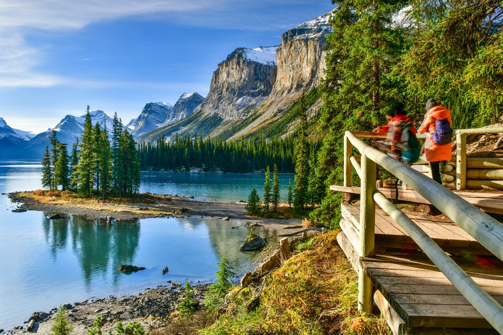
Spend the day exploring Jasper National Park. Twice as vast as its southern neighbor, Banff National Park, this is the largest national park in the Canadian Rockies and home to countless lakes, hiking trails, and a variety of wildlife. Many of the park's main highlights are located within the Maligne Valley, a 15-minute drive northwest of town. Get there early (before 8 am) to beat the crowds, stopping first for a short walk to Maligne Canyon, a 160 ft (50 m) deep gorge carved out by the river over the course of 10,000 years. From there, you can rent a canoe or take a guided cruise on Maligne Lake just before midday before heading back to Jasper.
Other popular highlights the hike to Mount Edith Cavell and the cable car that takes you up Whistlers Mountain for panoramic views of the valley and the surrounding mountains. Keep an eye out for the park's wildlife at all times, as you're likely to see sheep and mountain goats along the valley trails.
You can also check out Miette Hotsprings (a 45-minute drive northwest of Jasper) on the same day depending on how much driving you're willing to do (or save it for another day).
Day 8: Jasper to Icefields Parkway (45 min)

Get an early start to enjoy the morning light over the Rockies and take your time to enjoy the iconic Icefield Parkway, today. There are numerous viewpoints and day hikes along the way (taking a day hike is the best way to escape the summer crowds!). Given you're not going far, today, consider opting for a longer hike that gets you into the alpine.
Driving time (Jasper to Icefields Parkway): 45 minutes (35 miles / 55 km)
Day 9: Icefields Parkway to Lake Louise (2 h 30 min)

Drive the final stretch of the Icefields Parkway which ends in Lake Louise. You'll pass by monumental glaciers, ice-blue lakes, enormous mountains and stretches of road that leave you eager to discover what's behind every curve.
Lake Louise Village serves as a base camp for a number of great (and quite popular) hiking trails in the area—and of course, is the access point to the iconic Lake Louise. Moraine Lake (20 minutes from Lake Louise) is another popular (if not more beautiful) lake that is best visited in the early morning to escape the crowds.
Driving time (Icefields Parkway to Lake Louise): 2 hours, 30 minutes (110 miles / 180 km)
Day 10: Explore Yoho National Park (from Lake Louise)

Drive 30 minutes west to nearby Yoho National Park. Slightly underrated in comparison to its neighbor, Banff National Park, Yoho is just as beautiful and is one of the best ways to escape the crowds around Lake Louise.
A Cree expression for "awe" and "wonder," start the day early to cover Yoho's highlights as well as to avoid the throngs of travelers. Drive to Emerald Lake and allow 90 minutes to walk the 3-mile (5.2-km) Emerald Lake Loop. Enjoy views of the jewel-hued waters encircled by spruce and firs and the snow-capped Rockies, including the iconic profile of Mount Burgess. Make sure to check out Natural Bridge on your way in or out.
Meanwhile, if it's serious hiking you're after, choose from one or two of over 250 miles (400 km) worth of trails. One of the best hikes in the Rockies is the Iceline Trail, a challenging 13-mile (21-km) roundtrip. It will take you the better part of the day (typically eight hours), but the views alone will supply you the fuel to keep going.
Then there's the wealth of trails that radiate out from picturesque Lake O'Hara with the longest only 4.7 miles (7.5 km). While it's possible to walk to Lake O'Hara (7 miles /11 km), reserve a seat on the Park's Canada shuttle bus (private cars are not allowed on the Lake O'Hara road) to spend more time enjoying the lake and its surroundings. Take the 2-mile (3.2 km) Lake Oesa Trail to climb an elevation of 787 feet (240 m) to overlook the lake. If you're experienced, opt for one of five Alpine routes for a bit of everything: alpine meadows, glaciers, and wooded hillsides.
Day 11: Lake Louise to Banff (1 h 15 min)

Leave Lake Louise behind and head south along the Bow Valley Parkway, an alternate and more scenic route to Banff compared to the faster, Trans-Canada Highway. This 30-mile (50 km) stretch of road between Lake Louise and Banff has a number of great stops, such as Morant's Curve, Castle Junction, and Johnston Canyon. Johnston Canyon is regarded as the highlight and try to arrive early to enjoy the morning light and to avoid the crowds that arrive later in the day.
For your best chances of seeing wildlife, hit the road early in the morning before the traffic builds up throughout the day (it's also beautiful in the morning as the sun lights up the waterfalls en route).
Note: From March 1 to June 25, the stretch between Johnston Canyon Campground and the Fireside Picnic Area of the Bow Valley Parkway is closed between 8 pm and 8 am to provide a safe crossing zone for wildlife.
Driving time (Lake Louise to Banff): 1 hour, 15 minutes (37 miles / 60 km)
Day 12: Banff to Canmore (20 min)

It's a short drive from Banff to Canmore which lies just on the edge of Banff National Park. Canmore used to be a mining town but now serves as a popular back-up location to the busier (and more touristy) town of Banff. Depending on who you ask, Canmore and its surroundings are arguably more beautiful and you'll be closer to Calgary for your onward journey. Canmore is also the gateway to Kananaskis Country—a beautiful region of mountains and lakes in the eastern foothills of the Rockies (yet without the crowds!).
Driving time (Banff to Canmore): 20 minutes (15 miles / 25 km)
Day 13: Hiking in Kananaskis Country

Kananaskis Country is a region south of Canmore that encompasses 10 provincial parks in the foothills of the Canadian Rockies. Overlooked by international visitors, this area is held dear by local residents given its lack of crowds, more pristine trails, and equally stunning vistas compared to Banff National Park.
From Canmore, follow the scenic Smith Dorrien Trail (gravel highway) into the heart of Smith-Dorrien Valley and make your way to the trailhead of your choosing. With several peaks over 10,000 ft (3050 m), there are numerous day hikes to choose from.
Day 14: Canmore to Calgary, Depart (1 h 30 min)
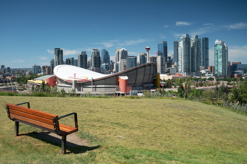
From Canmore, it's a short drive to Calgary's international airport. Be sure to leave ample time in case of traffic and to drop off your rental vehicle. En route look for signage leading you to the airport.
Driving time (Canmore to Calgary International Airport): 1 hour, 30 minutes (75 miles / 120 km)
Map
