How to Get from Lisbon to Algarve
173 miles ( 280 km) separate Lisbon and Algarve, and the trip can take between 2.5 hours to 3.5 hours depending on the mode of transport. There are four ways to get from Lisbon... read more
173 miles ( 280 km) separate Lisbon and Algarve, and the trip can take between 2.5 hours to 3.5 hours depending on the mode of transport. There are four ways to get from Lisbon... read more
The distance between Porto and Algarve is 345 miles (555 km), stretching down the length of Portugal. There are several ways to get between the two cities, and for most... read more
The port town of Lagos is located 187 miles (301 km) from Portugal's capital city of Lisbon. There are multiple ways to get between the cities, and each takes approximately four... read more
With just 60 miles (97 km) separating Porto and the Douro Valley, it’s a quick and easy trip. While the most practical way to visit the Douro Valley is with a car, some visitors... read more
The distance between Lisbon and the Douro Valley is 240 miles (380 km) with the journey lasting anywhere between three and seven hours. For most travelers, the best way to get... read more
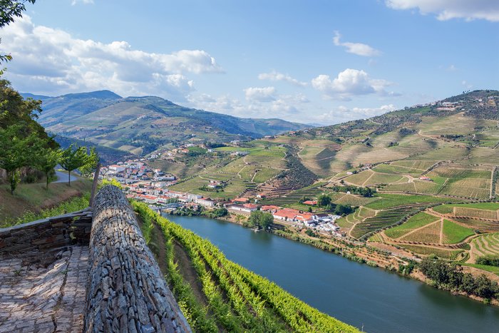
The Douro Valley was named a UNESCO World Heritage Site for good reason: grapevines growing on the region's idyllic hillsides produce famed table wine and port—a scene made even... read more
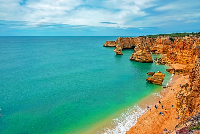
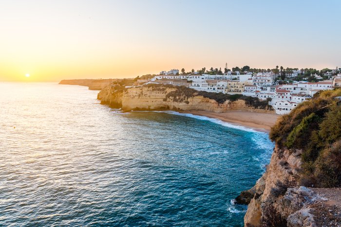
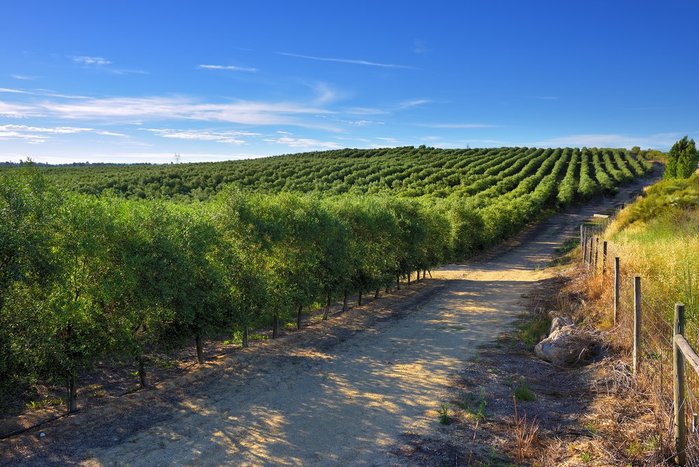
Accessing the Algarve region, in the south of Portugal, is easy via land transport from the rest of Portugal or from Spain. Its main hub is the city of Faro, the regional... read more
The journey between Lisbon and Porto is 195 miles (314 km) and averages between 2.5 to 3.5 hours. There are several ways to get between the two major cities, but the most... read more
Faro to Lagos is an easy and quick trip with a distance of 57 miles (91km). The fastest route is by car with a travel time of 1 hour and will give you the most flexibility. ... read more
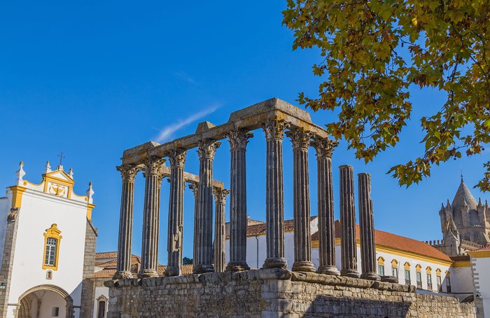
Traveling from Portugal's capital Lisbon to Évora, in the Alentejo region, is a distance of 83 miles (134 km). The fastest option is by bus, with frequent departures throughout... read more
Peneda-Gerês National Park is easily reached from Porto and Lisbon by car. Though public transport is possible, it’s not the ideal way to reach Peneda-Gerês National park since... read more
Reaching Peneda-Gerês National Park from the city of Porto, is a quick trip by car, covering a distance of 66 miles (107 km). The journey takes around an hour and fifteen... read more
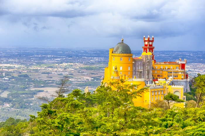
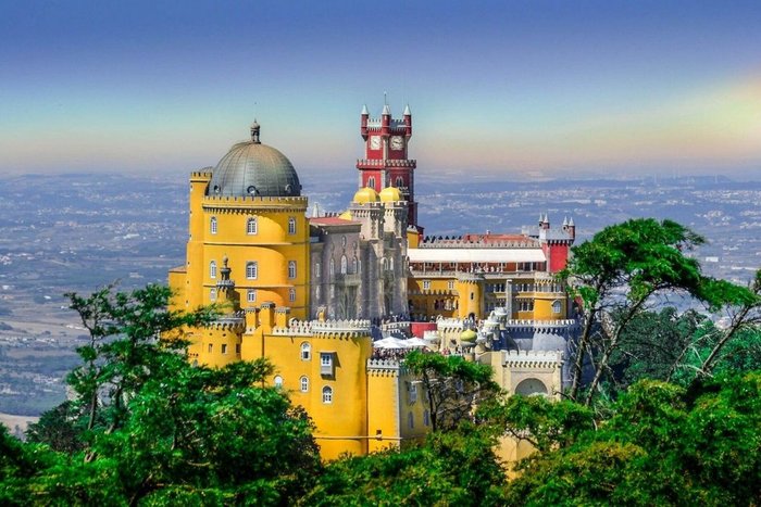
The hilly resort town of Sintra is a very popular day trip from Lisbon. It is home to many 19th and 20th-century villas and palaces, including the Pena Palace and Quinta da... read more
There are several options to travel from Lisbon to Faro, a distance of 175 miles (280 km). Air travel is the quickest way, though another convenient method is taking the train,... read more
The journey from the capital city of Lisbon to Óbidos is a distance of 53 miles (85 km) and takes a little over an hour. Going by bus is the fastest and most convenient way to... read more
The journey from Faro to Sagres, both in the Algarve, is 70 miles (113 km). Driving is the most convenient and efficient way to arrive in Sagres. Having a car also gives you the... read more
The distance between Porto and Faro is 344 miles (554 km), and the average journey is between three and six hours. The best and quickest way to get to Faro is by taking a direct... read more
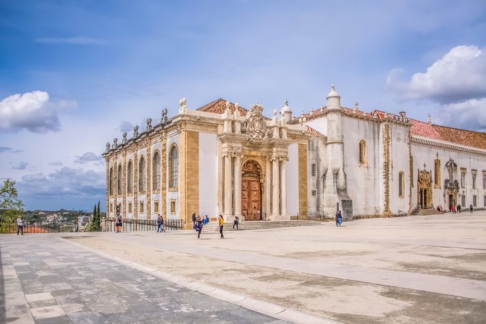
Traveling from Lisbon to Coimbra, a distance of 127 miles (205 km), is easy with various transport options. The train is the fastest way to get there and the most convenient.... read more
The distance between Portugal's capital of Lisbon and the mountainous region of Alentejo is 117 miles (189 km). The best way to travel to Alentejo is by train, as it will take... read more
Traveling from Porto to Coimbra, 79 miles (122 km), is easy with several transport options. Going by train is the quickest way, and the bus is a runner-up, both allowing you to... read more
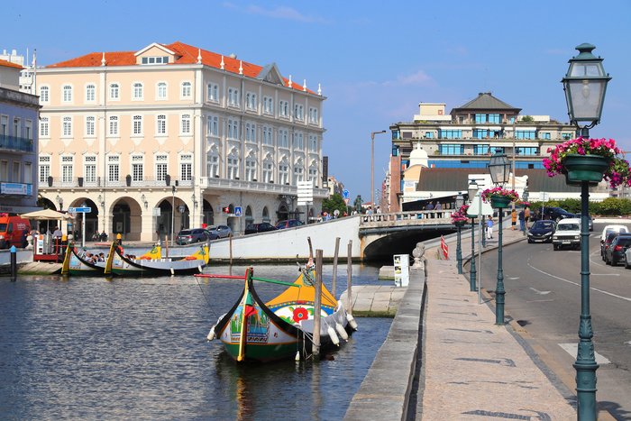
The distance between Porto and Aveiro is 46 miles (75 km), and the best way to travel between the two is by a quick 30-minute train ride. If you'd rather make the trip by car,... read more
The capital city of Lisbon to the Natural Park, Serra da Arrábidas is a quick trip. Covering a distance of 25 miles (40 km), the journey takes around forty-five minutes. Driving... read more
The journey from Faro in the Algarve to Évora, in the Alentejo region, is a distance of 83 miles (226 km). Driving is the quickest and most convenient option, giving you the... read more
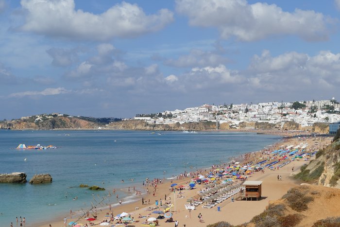
The distance between Faro and Albufeira, both located in Portugal’s Algarve region, is just 22 miles (36 km). The easiest way to travel between the two cities is by private... read more
The distance from the Portuguese capital of Lisbon to the historic resort town of Sintra is about 18 miles (29 km). Sintra is part of the Greater Lisbon Region, and is therefore... read more
Going from Lisbon to Aveiro, a distance of (254 km) is easy by car or by train. Both transport options take around the same amount of time, 2.5 hours. If you prefer to relax... read more
Traveling from Portugal’s capital Lisbon to the popular beach town of Ericeira, is a short distance of 30 miles (48km). Going by car is the quickest and most convenient option,... read more
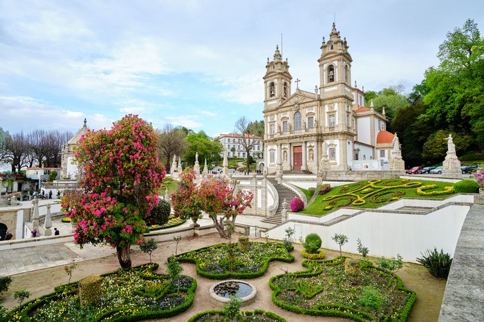
Traveling from Lisbon to Braga is 225 miles (362 km). There are various options to get to your destination. The train offers the fastest route and provides access to views you... read more
The journey from Faro to Tavira, both towns in the Algarve region, is a short distance of 24 miles (38 km). Driving and taking the train are the easiest ways to arrive in... read more
Porto and the ancient city of Braga are 34 miles (55 km) apart, and the best way to make this short journey is by a direct Comboios de Portugal train. If you'd like to go by... read more
Reaching the Alentejo region—known for vineyards, medieval architecture, and Roman villages—is easy by car or private transfer. Beja and Évora are the most well-known towns in... read more
Traveling from the capital city of Lisbon to the town of Beja is a journey of 111 miles (178 km). Driving is a convenient option and gives you the opportunity to go at your... read more