Best Day Hikes in Iceland

Which hike should you do?
All the walks listed here are more than two hours in duration, but may vary in length, elevation and difficulty. If you prefer an easier hike, you may want to try the hiking routes in the West Fjords or Skaftafell. More experienced trekkers will want to hit the slopes of Thorsmork and Fimmvörðuháls, to test their skills out on the dramatic and rugged terrain of Iceland.
#1 Landmannalaugar

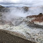
The highlands at Landmannalaugar are famous for their colorful rhyolite mountains and steamy streams. Hikers can take the 4-5-hour road through Laugaharaun lava fields, Vondugil canyon, and the sulfur-skinned Mt. Brennisteinsalda. Continue down into Graenagil, and if time and weather are favorable, you may want to climb up Blahnukur summit for its panoramic views. Don’t forget your swimsuit for a post-hike soak in one of the area’s geothermal pools.
#2 Thorsmork

In the Thorsmork wilderness, hikers can venture out on long but uncomplicated treks, or hit the more demanding trails. We recommend that you base yourself at one of the Volcano Huts and spend a few days exploring. Pick up a trail map to view your choice of routes. The Thorsmork Highlights trail (3-4 hours) leads you along the foothills of the Tindfjöll Mountains, through the birch forests of Húsadalur Valley and circles back to the Huts. Alternatively, Stakkholtsjá Canyon (2-4 hours) is an easy and scenic hike. Catch a 15-min bus ride at 12:30pm from the Huts to the canyon. From the base, cross the Krossá River on footbridge, skip across a small river, and hike past high cliffs and waterfalls into the Stakkholtsgjá Ravine. For experienced hikers, head into the Tindfjöll Circle (5-6 hours), a circuit of steep ridges, deep valleys and steamy rivers.
Chat with a local specialist who can help organize your trip.
#3 Fimmvörðuháls

Walk between two giant, dormant volcanoes in the wild terrain of Fimmvörðuháls. This challenging hike of 25 km will demand 12-14 hours of your endurance--so make sure you have sturdy shoes. Start your trek behind Skogafoss waterfall, where you’ll pass as many as 26 cascades as you follow the eastern bank of Skoga river. After a night in a mountain hut, continue onto pumice fields to the infamous volcano, Eyjafjallajökull, which erupted in 2010 and spread ash throughout mainland Europe.
#4 Skaftafell

Skaftafell wilderness area in Vatnajökull National Park is rich with hiking routes, most of which are hikeable for the average hiker. On the Skaftafellsheidi route (10.4 miles, 16.7 km round trip), the bridge near Magnúsarfoss will take you through to Sjónarsker, Kristínartindar, Gláma, and then on back to the Visitor Centre, in a hike of around 5-6 hours. Hikers who prefer longer days (6-8 hours) of difficult trekking, may want to try the route through Kristínartindar (11 miles, 17.9 km). Follow the path from the visitor center to Sjónarsker, then at the crossroads of Kristínartindar, turn left and follow the trail onto steep scree. You return through Gláma, Sjónarnípa and finally to the Visitor Centre via Austurbrekkur. Skaftafell is renowned for its sunny summer weather, birch forests, and Arctic foxes, surrounded by dramatic glacier tongues, so you’re likely to have spectacular scenery if you visit in July or August.
#5 Súðavík to Ísafjörður

This challenging hike over the mountain begins in Sudavik, a fishing village in the Westfjords, and ends in Isafjordur in about 5-6 hours. The steep incline rewards you with incredible panoramas of Vigur Island and Hornstrandir Nature Preserve across the deep fjord. Hike up to Sauratindar plateau, at 856m the highest point in the Isafjardardjup Bay.
#6 Borgarfjörður Eystri

Stórurð, whose name means “The Giant Boulders,” is so-called as it’s home to huge rocks and green ponds at the base of Dyrjöll. It’s a tranquil, quiet area, full of mossy meadows and boulders silhouetted by majestic mountains in the distance. Stórurð was made famous by Kjarval, Iceland’s renowned painter, who featured the mountain in many of his paintings. The trail is fairly easy (6-8 hours), only it has a short steep ascent on Geldingafjall. Take Road number 94 or hike 2-3 hours from Borgarfjörður Eystri to get to the area.
#7 Hornstrandir

The most isolated part of the Westfjords, Hornstrandir is fantastic for hiking. With snow-white fjord fingers and grassy slopes, this bumpy peninsula is worth exploring for a couple days or more. Trekking through here is like walking on the edge of the Earth--nothing but geese and Arctic foxes. At certain bays, you’ll stumble onto old housing foundations and a handful of summer residences. The only civilization you'll see here is the Doctor's House at Hesteyri, built in 1901 and now housing a café, restaurant and sleeping bag accommodation in the summertime. One 6-7-hour hike will take you over hills from the semi-abandoned settlement of Sæból in Aðalvík Bay, past an old church to Hesteyri. The boat leaves in the morning from Ísafjörður to Sæból, and returns from Hesteyri in the evening.


