

Highlights
- Ascend past 26 waterfalls, known as ‘Waterfall Way’
- Stand atop the youngest mountains in the world
- Pass between the doorsteps of two giant volcanoes (Eyjafjallajökull and Katla)
- Start your hike at Skogafoss, one of Iceland’s most famous waterfalls
- Walk atop some of the most recent geological activity on earth
- Descend through Goðaland, the "Land of Gods"
- Leave the crowds behind after ascending past Skógafoss waterfall
Overview
| Fast facts | |
|---|---|
| Min. duration | 12-14 hours |
| Start/finish | Skógafoss / Thórsmörk |
| Difficulty | Challenging |
| Distance | 25 km |
| Max. elevation | 1068 m./ 3504 ft. |
| Best season | July-Sept |
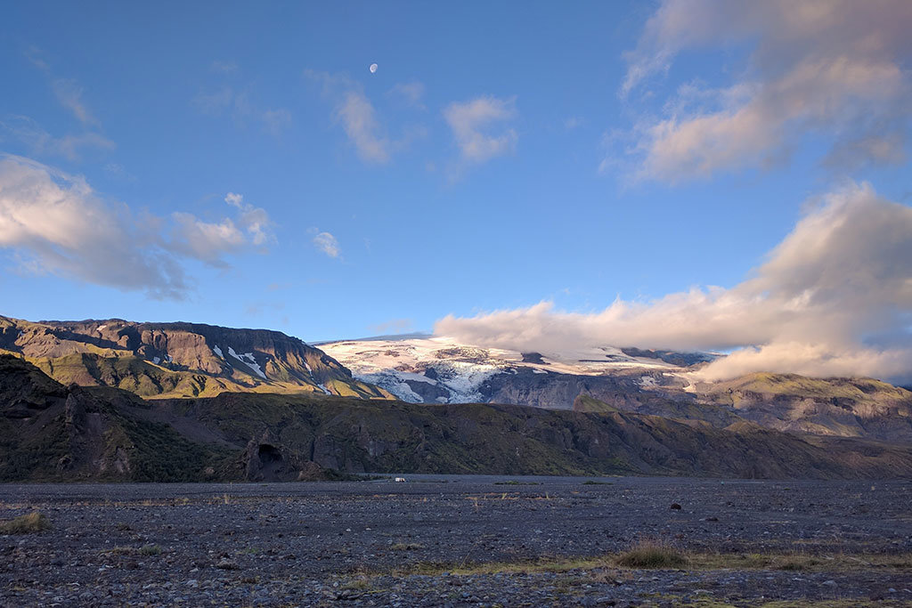
Among the many hiking trails in Iceland, the Fimmvörðuháls hike (also referred to as the Fimm hike) is one of the best day hikes. It’s located in the southwest — one of the busiest tourist regions of Iceland — yet few travelers complete the full hike. The highlight of this hike is being able to walk through a wide diversity of landscapes within a day: starting at the ocean, going up past 26 waterfalls to grassy tundra, then across a volcanic plateau home to some of the world’s most recent volcanic activity.
There’s a mountain hut halfway into the hike (Fimmvörðuháls Mountain Hut) that has room for 20 people (a shared room with small mattresses on the floor). However, there is no water in the hut, but water can be found in multiple spots along the hike
Getting there & away
From Reykjavik, it’s a two-and-a-half-hour drive to Skógafoss waterfall from where the hike begins. You’ll want to get an early start, as this is a long day-hike and you don’t want to finish too late in the evening.
The trail ends in Thórsmörk (named after the Norse God, Thor), which is a region of the river valley accessible by road from the Ring Road and with accommodation and camping spots. The road follows the river valley back to the Ring Road (1 hour of driving) on a bumpy gravel road with multiple river crossings. A word of warning: don’t attempt this in a rental car, but rather arrange super jeep transport or catch the local bus that plies this route.
Chat with a local specialist who can help organize your trip.
Description of the trail
The trail has three distinct sections, each geographically unique:
- Skógá River to the Fimmvörðuháls mountain hut
- Passing between Eyjafjallajökull and Mýrdalsjökull glaciers
- Goðaland, the area leading down toward Thórsmörk
Part 1: Skógá River


The first section of this hike is marked by 26 waterfalls (the exact number is open to debate!) as you follow along the eastern bank of Skógá river. It’s tempting to stop at each waterfall to enjoy the views, yet rest assured there’s another one just as impressive around the corner. Set amidst a dramatic backdrop of the North Atlantic Ocean, rocky peaks and altogether other-worldly terrain.


Part 2: Volcanic plateau
One-third of the way in, you’ll cross the Skógá river over a narrow bridge and enter a volcanic region between two glaciers. The scenery undergoes a stark change from a lush river canyon to barren volcanic rock with scattered patches of vegetation and moss. The trail slopes gently upward for a few kilometers until you reach the hut. You may come across Icelandic sheep feeding high up in these fields for the summer.


From there, you cross a few snowfields until you reach the pass, revealing the site of some of the world’s most interesting recent volcanic history. This is the scene where the infamous Eyjafjallajökull volcano erupted in 2010, spreading ash throughout mainland Europe. Since this was a fissure eruption with 13 craters, there is no pronounced steep volcano-shaped mountain but rather several new ‘bumps’ in the landscape.


Across a snowfield, you will see two six-year-old mountains—Magni and Móði—with a trail edged into its red, crumbled lava rock. When you approach these new peaks, pick up some of the rocks and feel how light they are. Dig into the ground a little and you may still be able to feel the heat emanating from the magma far below. Hike across the two mountains and marvel at the fact that you are walking through one of the youngest landscapes on earth.
Local Iceland expert and founder of Midgard Adventure, Sigurður Sveinsson, explains the story behind the recent Eyjafjallajökull eruption and formation of Magni and Móði. Sigurður grew up not far from here, first getting to know this local area as a park ranger.
Part 3: Descent to Thórsmörk
After leaving the upper volcanic fields, heading north, you’ll begin the descent down to Thórsmörk along a ridgeline with great vistas both to the east and west, looking down into deep canyons and across barren plateaus. After a short and rocky descent, you’ll emerge onto a large, expansive plateau where you’ll hike for 1 km before dropping down to Krossá river (roughly 4.5 km from the plateau to the end of the trail).


Variations
Go half way
If you’re short on time or don’t wish to suffer through a 12-hour day of hiking, consider hiking just the first section of the trail (from Skógafoss waterfall to the bridge that crosses over Skógá River at 8 km into the hike (16 km round-trip). It’s a leisurely uphill trail, with plenty of places to stop for water and views along the way. You’ll escape the crowds at Skógafoss, and still be able to enjoy the amazing series of waterfalls along this hike.
Hvannárgil Canyon
As you descend toward Thórsmörk after passing through the volcanic plateau, you have the option of veering west and descending into the Hvannárgil canyon along a route called Votupollar. Follow a beautiful canyon trail all the way to the campground at Thórsmörk. This trail is shorter than the main route but takes a bit longer given that the trail is somewhat more technical. Only consider this option if you are sure-footed and don’t mind narrow tracks with steep drops!
Laugavegur Trail
If you the time, consider combining the Laugavegur (four days) and Fimmvörðuháls (one day) trails into a five day hut-to-hut hike. Laugavegur is known for its multi-colored mountains and dramatic scenery and has mountain huts (payment required) along the way for accommodation.


When to go
The best season for hiking in Iceland is generally from July to mid-September, when the weather is at its best and the trails are clear of snow. Keep in mind, the weather is one of the main factors regarding the difficulty of this hike. If it’s windy or cloudy, navigation and warmth can become a challenge. Best to check the weather beforehand and ensure that you have the right gear in case of sudden weather changes.
Read more: Best time of year to visit Iceland
What to bring
- Bring layers: the weather can change quickly in the mountains (especially in Iceland), so best to bring layers that you can take on and take off depending on the weather
- Sunglasses: if it’s a sunny day these are always useful
- Hat: again, if it’s a sunny day
- Water bottle: there are many places to fill your water bottle along the first along Skógá river, but spots are few and far between after that


Spelling & local names
The Icelandic language has its own unique characters, sometimes translated both with or without accents. Often the names are quite similar making terms easy to recognize, but we’ve added a table below of common terms used in this article to help recognize these terms during your trip.
| English version | English with accents | Icelandic characters |
|---|---|---|
| Fimmvorduhals | Fimmvörduháls | Fimmvörðuháls |
| Thorsmork | Thórsmörk | Þórsmörk |
| Eyjafjallajokull | Eyjafjallajökull | Eyjafjallajökull |
| Modi | Módi | Móði |
| Godaland | Godaland | Goðaland |
| Skogafoss | Skógafoss | Skógafoss |
More Iceland Hiking Guides
If you want to spend more time exploring Iceland's natural landscapes, we've put together a few other guides for our favorite trails around the country:
Map

