If you're driving from further east than Vik, be sure to check out our article on Top Sights and Stops from Egilsstadir to Vik
Vik (and nearby)
Vik can be a good stopover destination on your drive along the south shore. While the town itself is fairly small, its proximity to several great sights more than make up for it, allowing you to explore more of the area in the evening when the larger crowds have left or before the crowds arrive the next day.
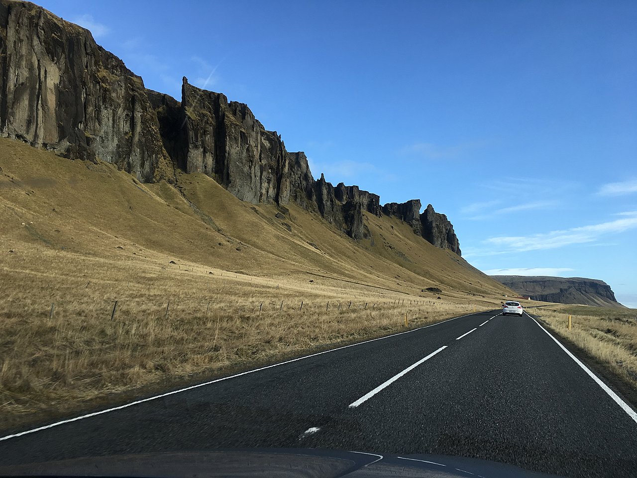
Towards the water, you will find a black sand beach with high cliffs on the right side, often filled with soaring and nesting birds.

Reynisfjara Beach

A few minutes drive to the west and you will find the turnoff for Reynisfjara Beach, past a pretty church as you drive towards the water. This black rock beach (not as fine grain as the one in Vik) is most famous for the Reynisdrangar Columns, huge basalt hexagonal columns rising up out of the sand. Walk around the cliffs to the left as you face the ocean and you will find a couple of large caves as well. Far in the distance to the west, you may be able to see the arch of Dyrholaey, the next major stop along the drive west towards Reykjavik.
Practical Info: At the parking lot you will find a WC and restaurant with wifi.
Dyrholaey Arch and Cliffs

At Dyrholaey there are 2 parking lots from which you can see the famous arch. The one high on the hill has the better view. You can either take the bumpy dirt road to your right as you enter or better yet hike a short trail near the cliff’s edge to the view at the top (15-20 minutes up). From the top, you will also see a lighthouse and great views looking farther west along a black sand beach that reaches as far as you can see. Look for birds flying around, they nest along the cliffside.
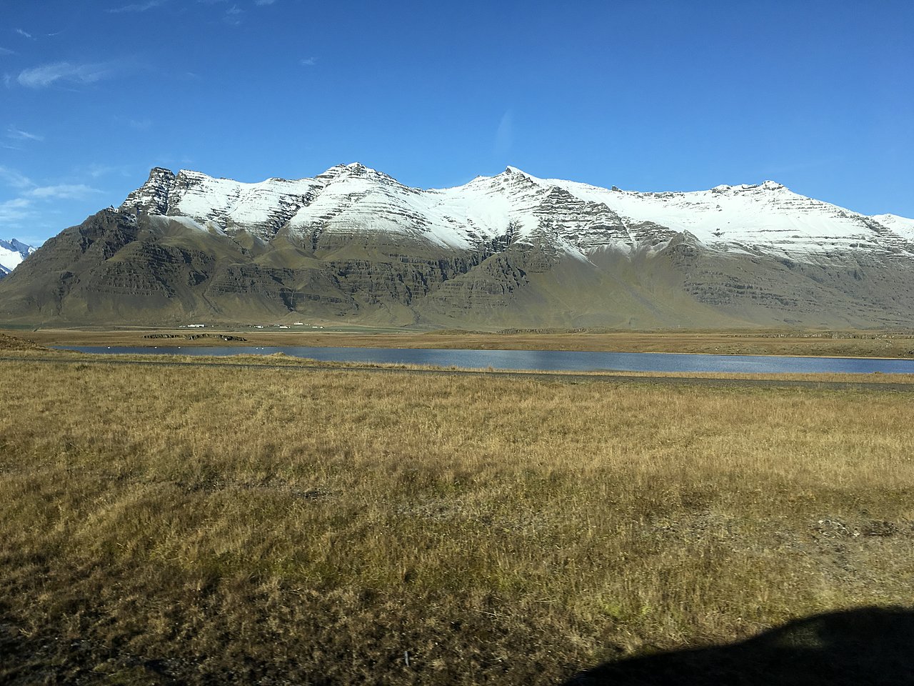
Myrdalsjokull Glacier
Iceland’s 4th largest glacier covers the volcano Katla, which has recently had elevated activity levels after over 100 years of remaining dormant. Here you can join a snowmobile tour on the glacier if you’re looking for a bit of an adrenaline rush.
Chat with a local specialist who can help organize your trip.
Crashed DC-3 Plane on Sólheimasandur Beach

If you’re looking for an odd sight along the south coast, look no further. This US Navy airplane, a Douglas Super DC-3 was forced to crash land here on November 24, 1973. Fortunately, all passengers survived, but the wreckage remains to this day. You can no longer drive directly to the site; park off on either side of the road (you will probably see other cars) and walk the 4 km / 2.5 mi path to the water. Close to the water you will see the wreckage of the DC 3 Plane on your left.
While interesting (and great for photographs), it takes about 2 hours to hike out there and back, so if you’re already planning to see a lot, plan accordingly.
Skogafoss Waterfall and Fimmvörðuháls Hike

Skogafoss Waterfall marks the beginning of the 26 km / 16 mi Fimmvörðuháls Trail which ends in Thórsmörk. If you want to do the full hike you can arrange to be picked up on the other side. (read more about the Fimmvörðuháls Hike).
If you prefer a shorter stop, you don’t have to go far from the parking lot to see Skogafoss. In fact, you could see it from the car if you want, but it’s much better to see up closer where you can feel the mist on your face (don’t get too close, the changing wind could leave you very wet).
For more great views, climb the stairs to the right up to the top of the waterfall and continue along the trail for a few minutes to see the river curve through the canyon with some strange rocky formations broken up by more waterfalls and cascades. Hike for as long as you like, you can see up to 26 waterfalls along “Waterfall way” if you keep going.
Practical Info: You will also find a WC at the parking lot, a couple restaurants, and wifi.
Seljavallalaug Pool
A short distance after Skogafoss you can make a detour to Seljavallalaug, one of the oldest swimming pools in the country, built in 1923 (look for the small sign to Seljavellir). A short hike past some very cool scenery will take you to the relaxing pool.
Seljalandsfoss Waterfall

While Seljalandsfoss would be amazing enough to look at from the front, you can actually walk behind this waterfall for a different perspective. Standing in a cave under the cliff you will see the water come roaring town 20-30 feet in front of you. Pay attention to the direction of the wind, or wear a rain jacket (or both!). You will find 2 smaller waterfalls to the right (if you are looking from behind the waterfall).
Practical Info: The waterfall is only 1 minute from the parking lot. You will also find a food stand selling sandwiches and a store selling local Icelandic wool items such as sweaters, hats, gloves, and blankets.
Heimaey Island in the Westman Islands

To really escape the crowds along the popular south shore, add in a couple day retreat to the Westman Islands (Vestmannaeyjar). Visit the aftermath of the famous eruption in 1973, lasting 6 months. Here you can also find one of the world’s largest puffin colonies, take a hike, or go whale watching.
Urridafoss
As you reach the end of the south coast drive consider one last waterfall: Urridafoss. While this waterfall may not be as pretty as Skogafoss or Seljalandsfoss, it makes up for it in other ways. Urridafoss is the largest volume waterfall in Iceland, and very wide (and loud). It’s only a short trip from the ring road, and a good finale to the south.