How to Get from Nice to Saint-Tropez
Saint-Tropez is located about 62 miles (100 km) from Nice, traveling southwest along the French Riviera. The iconic fishing village's location on a rocky peninsula—with no train... read more
Saint-Tropez is located about 62 miles (100 km) from Nice, traveling southwest along the French Riviera. The iconic fishing village's location on a rocky peninsula—with no train... read more
The medieval hilltop village of Èze is just 7 miles (11 km) up the coast from Nice, making it a popular destination for day trips from the Riviera's capital. The simplest and... read more
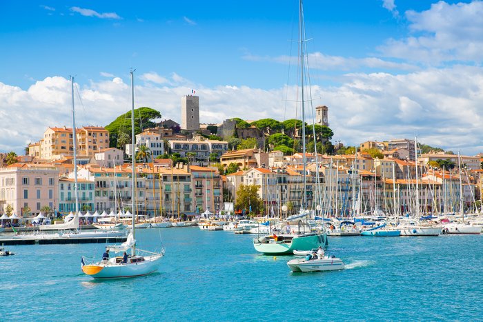
The distance between the two destinations of Nice and Cannes on the French Riviera is 16 miles (26 km), traveling southwest along the coast. The easiest way to make the trip is... read more
The tiny principality of Monaco lies to the north of Nice, with barely 12 miles (20 km) of Mediterranean coastline separating it from the Riviera capital. Between high-speed... read more
Nice lies roughly 425 miles (685 km) miles southeast of Paris, on the far eastern edge of the French Riviera. Despite the distance, travel between the cities is relatively easy,... read more
The French region of Provence is famous for its sunny climate, beautiful natural landscapes, and picturesque towns. The most well-known cities in the area include Marseille and... read more
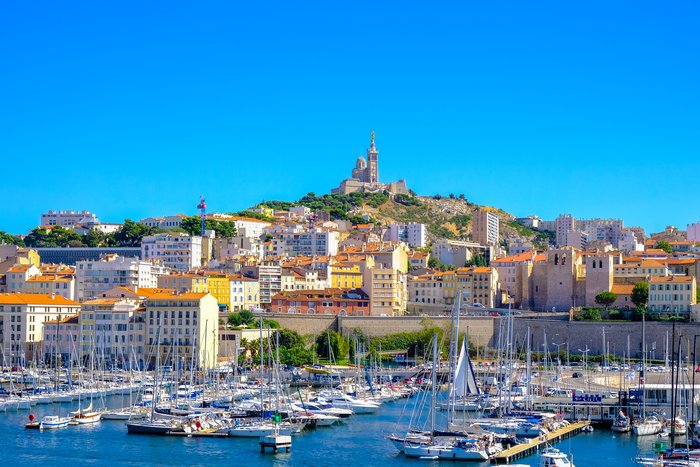
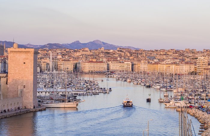
Marseille and Nice lie roughly 100 miles (16) km) apart, on opposite ends of the Cote d’Azur. Traveling from France’s second-largest city to the capital of the French Riviera... read more
A distance of approximately 92 miles (148 km) separates Aix-en-Provence from Nice, traveling east across Provence to the northeastern edge of the Cote d'Azur. Driving is the... read more
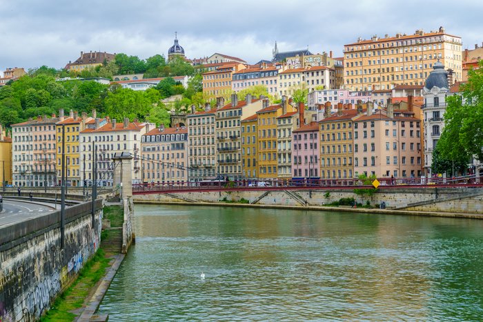
The distance between France's capital city Paris and the country's gastronomical epicenter Lyon is 243 miles (392 km) traveling southeast. The easiest way to make the trip is by... read more
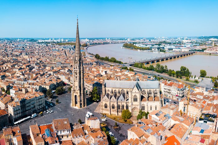
The fastest and easiest way to get to Bordeaux from any major city in France (and the world, for that matter) is to fly. The Bordeaux-Merignac International Airport (BOD)... read more
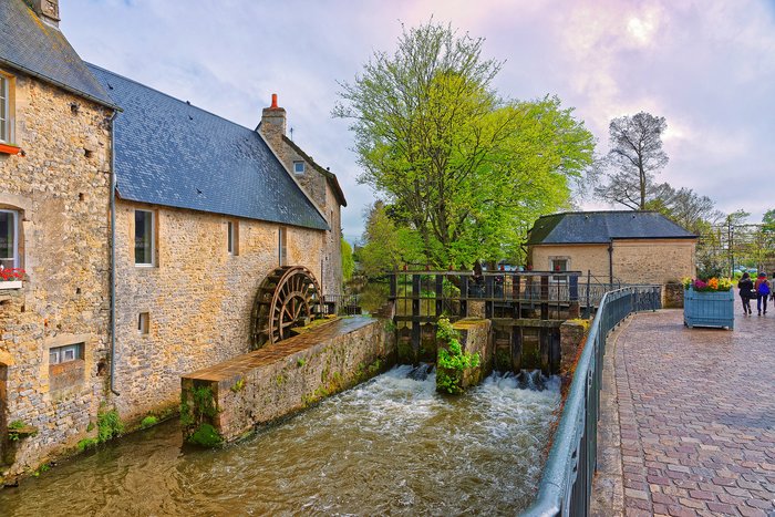
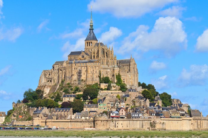
Bayeux and Mont-Saint-Michel are two of the most popular places to visit in France's Normandy region, and they are just 77 miles (125 km) apart. It is easy to get from Bayeux to... read more
Marseille, France's second-largest city, is 410 miles (660 km) away from Paris. Highspeed TGV trains connect the two cities, and there are also several direct daily flights from... read more
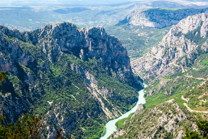
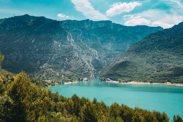
Nice is approximately 86 miles (138 km) away from the Verdon Gorge, the deepest canyon in France. Your best bet is to either rent a car or book a private transfer, as public... read more
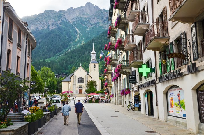
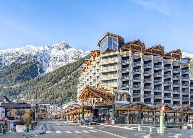
Chamonix, a ski resort town known for skiing in the winter and hiking in the summer, is 290 miles (470 km) away from Paris. Transport options between the two destinations... read more
The best options for getting from Paris to Bayeux are taking the train or traveling by car. The two cities are just 163 miles (262 km) apart, the roads are well-maintained, and... read more
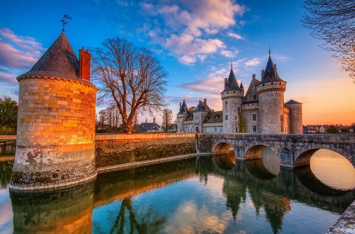
Known for its delicious wines and many beautiful chateaux, the Loire Valley is only a short train or car ride from Paris (110 miles/175 km). If you only have a few days to... read more
Saint-Tropez is located 63 miles (101 km) southeast of Aix-en-Provence, roughly halfway between Marseille and Nice on the French Riviera. Despite the village’s fame, getting... read more
Annecy is perhaps the most popular day trip from beautiful Lyon. Vacationers do well not to miss out on this town's river views, Alpine backdrop, and gingerbread-like houses. ... read more
Although most people come to Annecy from Lyon, Paris is perhaps the second most convenient starting point for a visit to this charming rural town. The journey by car—either by... read more
The small, picturesque city of Aix-en-Provence, or just Aix as the locals call it, is a bit over 15 miles (24 km) north of Marseille, the biggest city in the south of France. If... read more
Aix-en-Provence, a small city north of Marseille known as the "city of a thousand fountains," or simply as Aix, is 395 miles (635 km) south of Paris. The easiest way to reach it... read more
The Verdon Gorge is the largest canyon in Europe and is a prime destination for outdoor activities like hiking, kayaking, and rafting. Driving (with a rental car or with a... read more
Located on the border with Germany, Strasbourg is a unique French city. It is known for its architecture, Christmas Market, and strong German influences. Flying provides the... read more
Located in France's Occitanie region, the fortified city of Carcassonne is famous for its medieval ramparts and centuries-old buildings. Most tourists either drive to... read more
Getting to Brittany (or Bretagne, in French), in northwestern France, is an easy train trip from Paris. Depending on where you go in the region—Rennes, Saint-Malo, or Brest—the... read more
Cannes and Aix-en-Provence are both located within France’s scenic southeastern region of Provence-Alpes-Cote d'Azur. Aix-en-Provence lies 80 miles (129 km) due west of Cannes,... read more
Marseille, France’s second-largest city and capital of the Côte d’Azur, sits 175 miles (282 km) south of Lyon on the Mediterranean coast. Travel between the cities is... read more
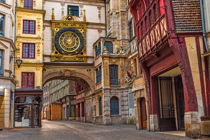
The city of Rouen, located in northern France, is approximately 84 miles (135 km) from Paris. Built on the River Seine and the capital of Normandy, this historic city can be... read more
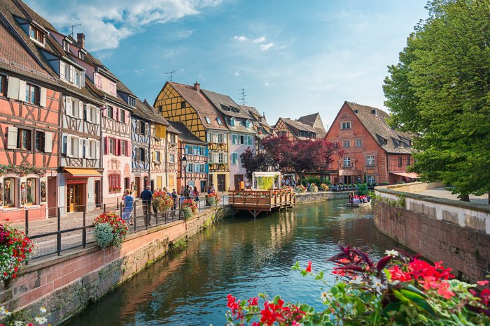
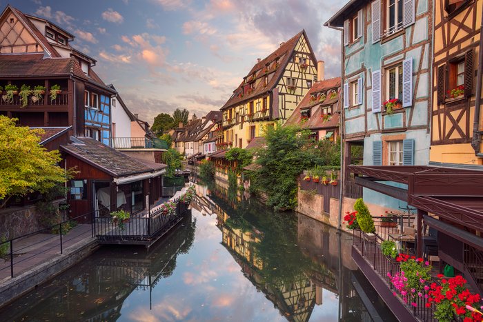
The 47-mile (76 km) journey from Strasbourg to Colmar should take you no more than an hour if you do not stop along the way. Frequent, fast trains run between the two cities,... read more
The Luberon Valley, composed of three impressive mountain ranges, is one of the most visually and culturally inspiring areas of Provence. Medieval small towns rise from the... read more
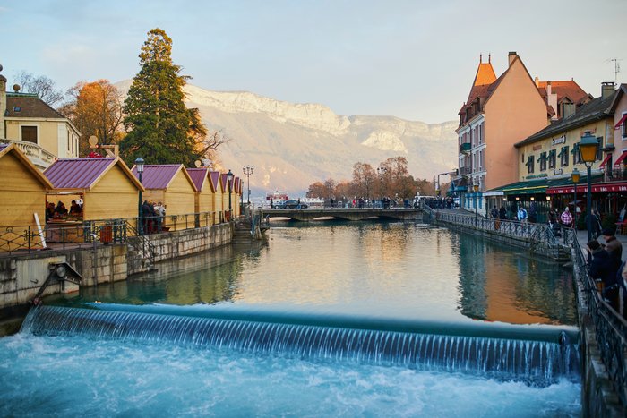
Annecy is a coveted destination: Its famous Christmas market, picturesque bridge, pastel-colored houses, and river views draw people from all over the world to it. Part of its... read more
Chamonix is a French mountain town in the Alps, near the borders with Switzerland and Italy. Getting there from Paris requires an easy 5.5-hour train ride or a combination of a... read more
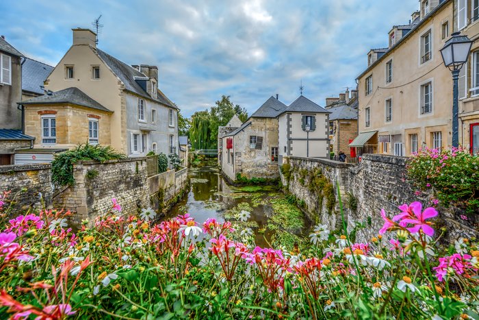
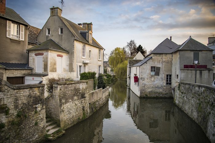
Historic Bayeux lies just 18 miles (30 km) northwest of Caen, capital of the Calvados region of Normandy in northwest France. The fastest way to make the journey is by rail,... read more
Mont Saint Michel is one of France's most incredible UNESCO sites. With the rising and lowering tides that continuously change its landscape, it is a site well-worth seeing. The... read more
The charming Medieval city of Bayeux sits 82 miles (132 km) due west of the Norman capital of Rouen, between the rugged north Atlantic coast and verdant countryside of the... read more
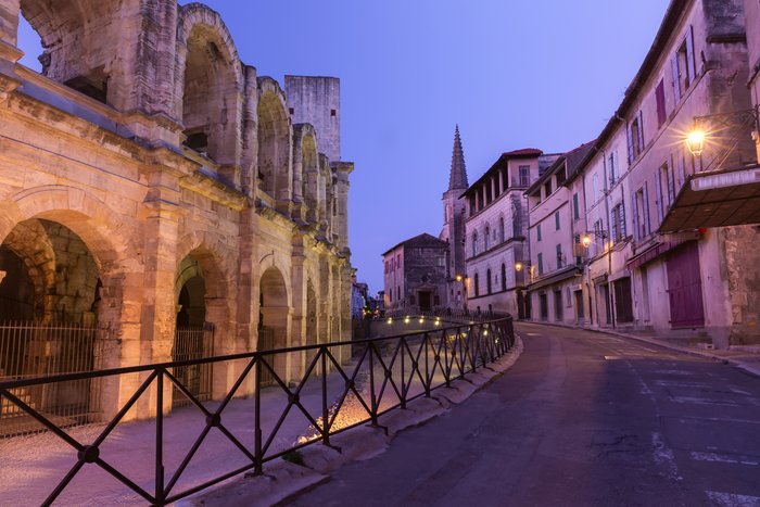
Arles, a city known for inspiring some of Vincent Van Gogh's most famous paintings, is a little over 40 miles (65 km) from Aix-en-Provence. If you're looking for family fun,... read more
Located in the beautiful Provence region of France, Avignon and Arles are 20 miles (33 km) apart. By train, it's a quick 20-minute ride, while driving will take you about an... read more
With many beautiful chateaux and vineyards, the Loire Valley is one of France's most popular regions, attracting six million tourists annually. Visitors often combine their tour... read more
Normandy is one of the most exciting regions in France. Its distinct culture, gastronomy, and architecture set it apart from everywhere else in the country. Normandy has also... read more
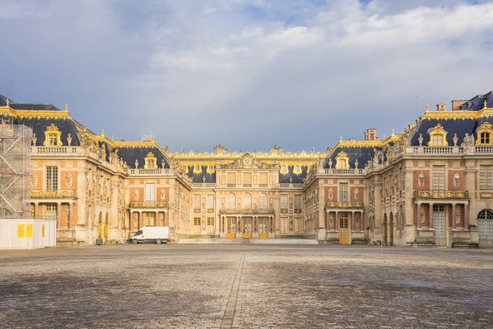
The famous Palace of Versailles is only 10 miles (17 km) away from the city center of Paris and is easily accessible by private transfer and train. If you're interested in... read more