How to Get to Triglav National Park
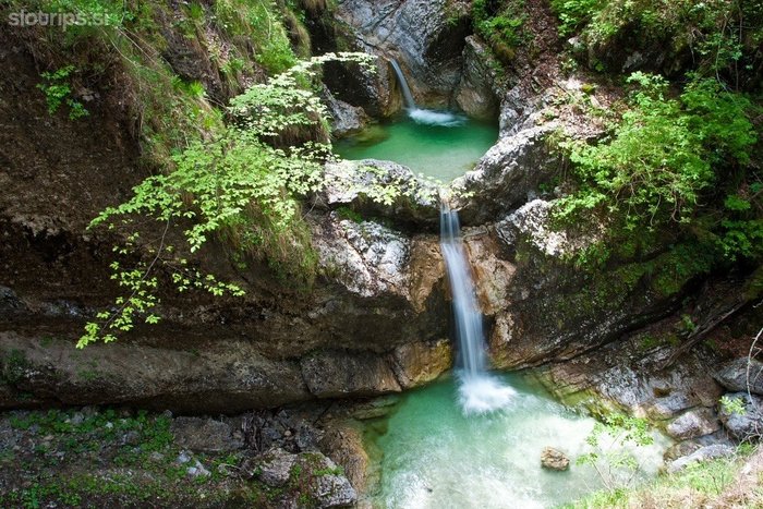
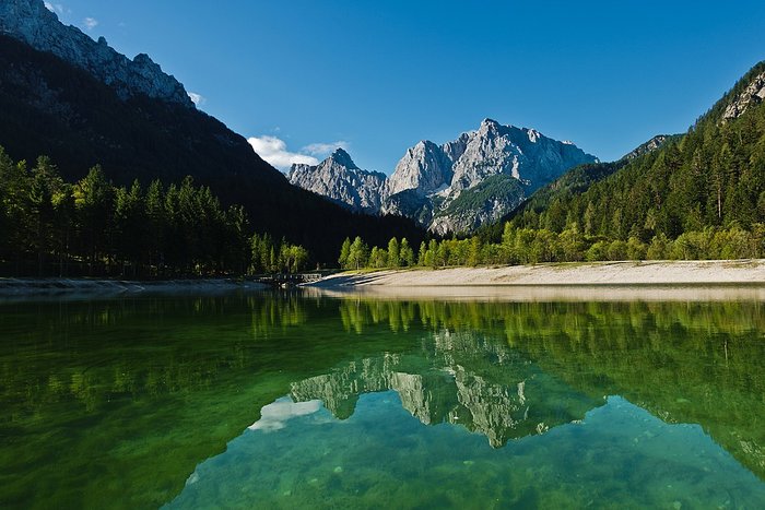
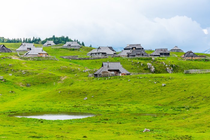
Triglav National Park is set in northern Slovenia, near the borders with Austria and Italy. It’s home to Vršič Pass, a famous mountain pass known for its curvy road and the... read more
Triglav National Park is set in northern Slovenia, near the borders with Austria and Italy. It’s home to Vršič Pass, a famous mountain pass known for its curvy road and the... read more
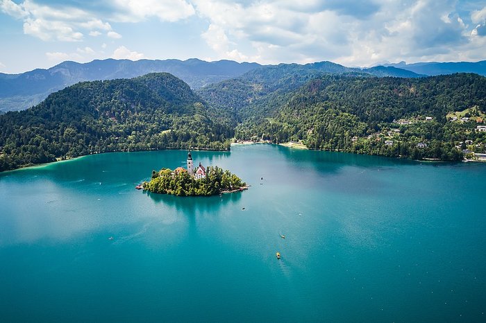
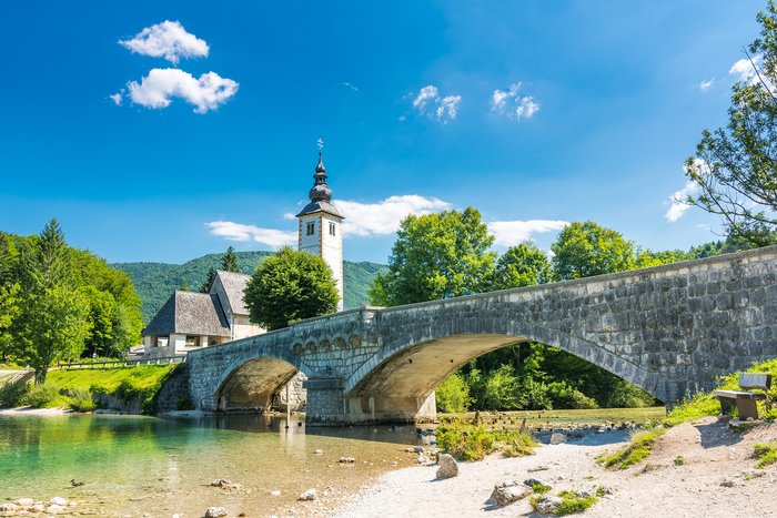
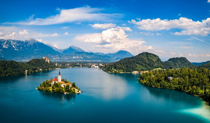
Set in northern Slovenia near Triglav National Park, Lake Bled is famous for picturesque Bled Island at its center and views of the neighboring mountains. Because it’s a major... read more
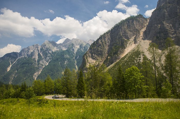
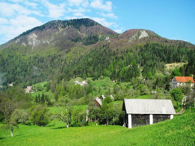
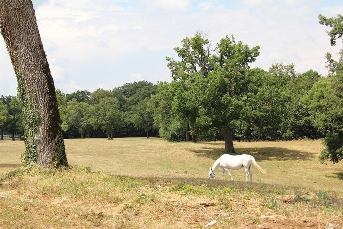
Triglav National Park—the home of the Julian Alps, Lake Bohinj, and Vršič Pass—is just about 50-80 miles (80-128 km) from Ljubljana. Although the park has numerous entry points,... read more
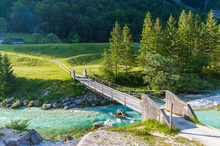
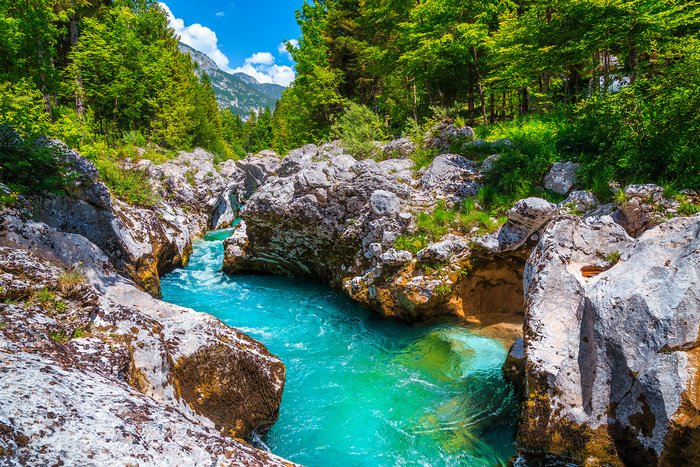
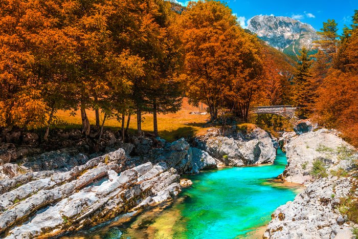
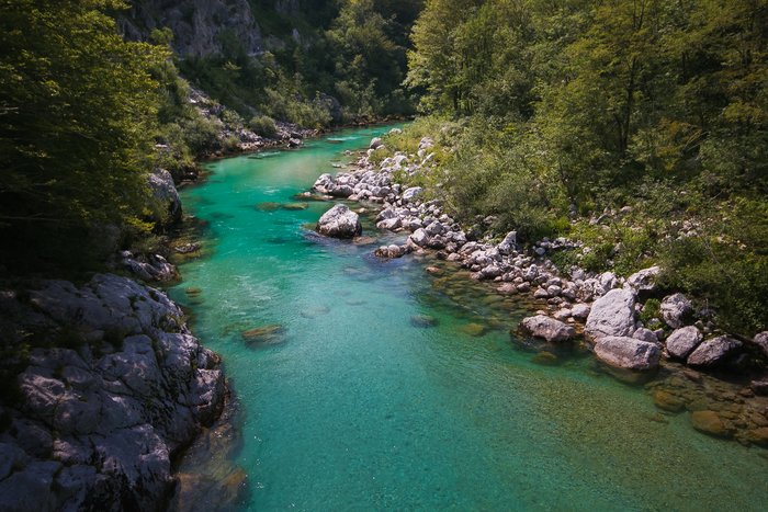
The Soča Valley starts in Slovenia’s Triglav National Park near the town of Bovec, following the emerald-green Soča River south and slightly east. The transportation hub for the... read more
The Soča Valley runs the length of the Soča River, with the town of Most na Soči as its transportation hub. Lake Bled is only 44 miles (70 km) from the Valley’s hub. The fastest... read more
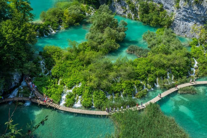
Thanks to Slovenia’s compact size, it’s fairly easy to cross the border and enjoy Croatia’s famed Plitvice Lakes National Park. The distance between Ljubljana and the park is... read more
The famous emerald waters of the Soča River Valley are just 52 miles (84 km) from Ljubljana. The region’s transportation hub is the small city of Most na Soči, which is most... read more
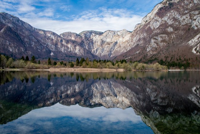
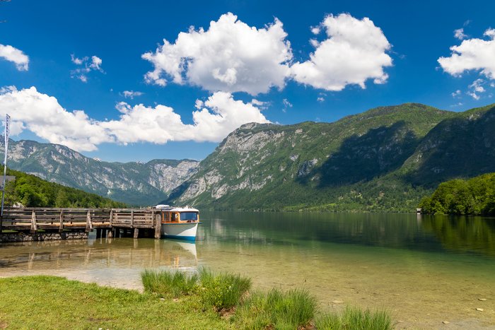
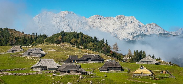
Set in Triglav National Park, Lake Bohinj is just 18 miles (29 km) from its better-known neighbor, Lake Bled. The fastest way to make the journey is by car—rental or private... read more
Bovec is a rural town just 53 miles (89 km) from Lake Bled. But with the two towns set on opposites sides of Triglav National Park, the journey isn’t direct. The fastest way to... read more
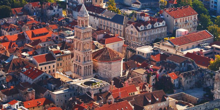
Ljubljana, the capital of Slovenia, and the Croatian city of Split are 284 miles (457 km) apart. The most convenient way to go is by car—rental or private transfer—a drive of... read more
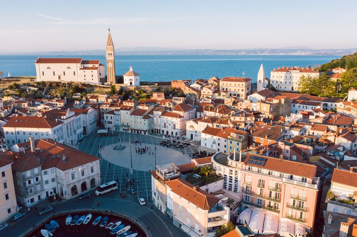
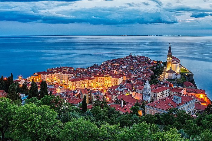
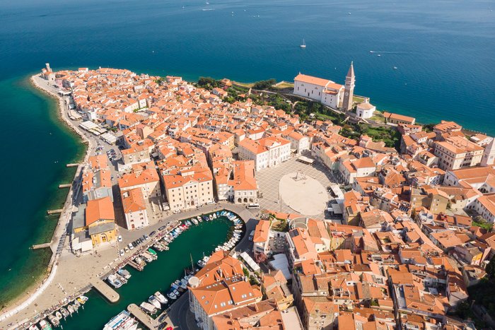
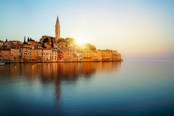
Slovenia’s capital, Ljubljana, is just 75 miles (121 km) from the seaside town of Piran. The journey, however, isn’t always quick. If you’re looking for speed and convenience,... read more
Lake Bled and Piran are 106 miles (171 km) apart, making a trip from the Alps to the seaside very doable in one trip. The fastest and most convenient way is by rental car or... read more
One of Slovenia's most popular destinations is Lake Bled, a dreamy city escape just 34 miles (55 km) from Ljubljana. Traveling by car—either rental or private transfer—is the... read more
Lake Bohinj and Bovec are located 70 miles (112 km) apart on opposite sides of Slovenia’s scenic Triglav National Park. The fastest and most convenient way to make the journey... read more
Lake Bled in Slovenia is 162 miles (260 km) from Croatia's famous Plitvice Lakes National Park. Despite being in two different countries, seeing these popular sights is doable... read more
Kranjska Gora, considered the northern gateway to Triglav National Park, is just 24 miles (40 km) northwest of Lake Bled. It’s most conveniently reached by car—rental or private... read more
The alpine towns of Kranjska Gora and Bovec—set 30 miles (40 km) apart—are the north and south entry points to Triglav National Park. To travel between the two, you’ll navigate... read more
Bovec—the western gate to Triglav National Park—is just 94 miles (152 km) from Slovenia’s capital, Ljubljana. The journey between the two is most conveniently done by rental car... read more
Trenta is located just 13 miles (20 km) from Bovec in one of Slovenia’s most coveted regions: the Julian Alps. The journey between the two is most conveniently done by... read more
Set in the scenic Logar Valley, Logarska dolina is just 39 miles (63 km) north of Ljubljana. Because Logarska dolina is quite rural, the best way to travel between the two is by... read more
Lake Bled is just 55 miles from Kobarid, making the journey easily doable in the same trip. The most convenient way to reach Kobarid is by rental car, which takes 2 hours and... read more
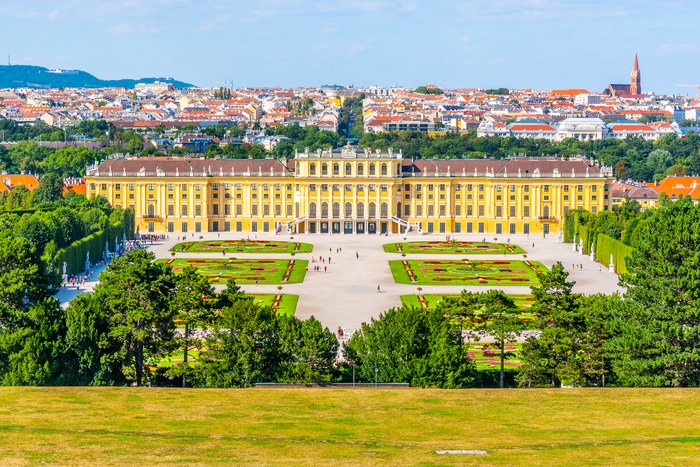
The Slovenian capital of Ljubljana is 240 miles (384 km) from the Austrian capital of Vienna. With major international highways and train routes linking the two, traveling... read more
Lake Bled is 120 miles (194 km) northwest of Croatia’s capital, Zagreb. Thanks to Slovenia’s small size and major highways, the journey is fairly quick and straightforward. You... read more
Bovec and Piran are 108 miles (174 km) apart, making this incredibly scenic trip from the alps to the seaside very doable in one trip. With that being said, the fastest and most... read more
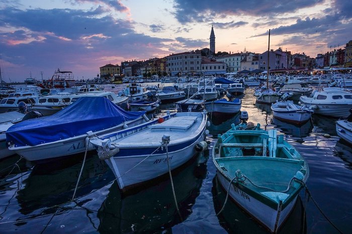
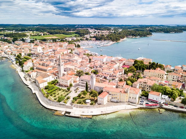
Set on the scenic Istrian Peninsula, the port city of Rovinj is only 50 miles (79 km) south of Piran. The two cities are linked by an international highway, meaning the most... read more
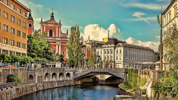
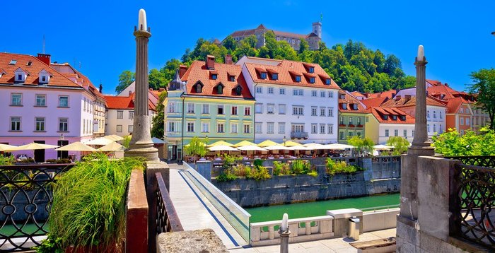
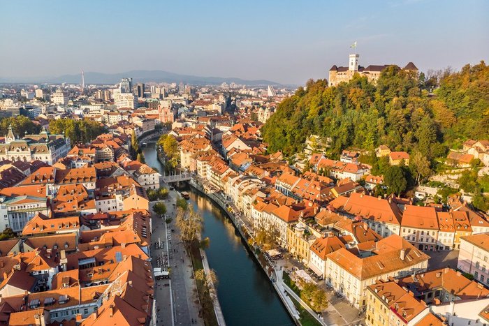
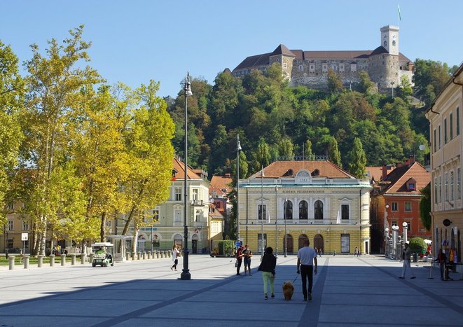
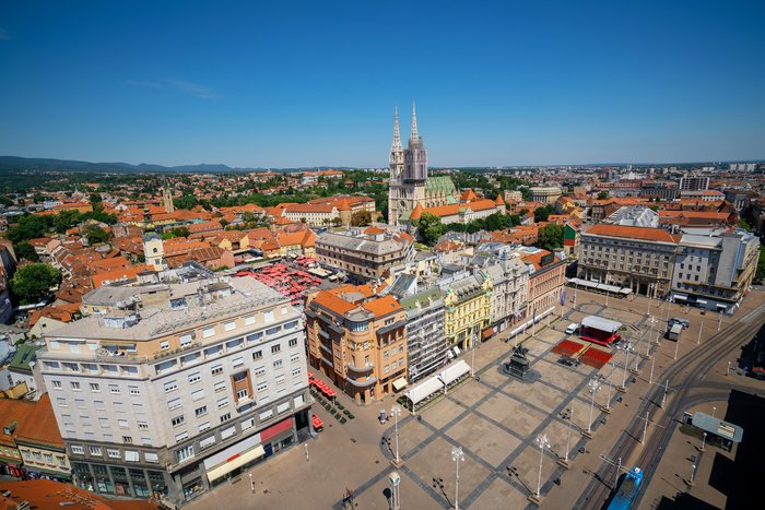
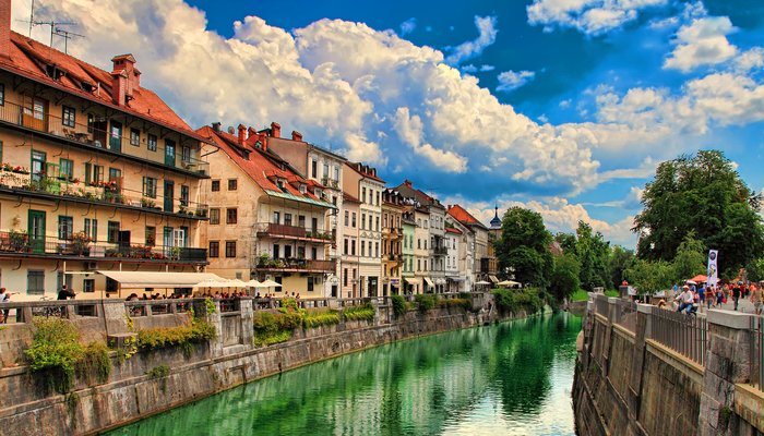
The relaxed Slovenian capital of Ljubljana is set in the center of the country—a common saying claims that “all roads lead into (and out of) Ljubljana.” This makes the city just... read more
Ljubljana and Maribor are set just 79 miles apart, making it fairly easy to visit Slovenia’s two biggest cities in one trip. The most convenient way to reach Maribor is by... read more
Kranjska Gora, the northern gateway to Triglav National Park, is just 40 miles (65 km) from Lake Bohinj. The fastest way to make the journey is by rental car or private... read more
Trenta is located just 16 miles (25 km) from Kranjska Gora, along one of Slovenia’s most scenic roadways, Vršič Pass. The narrow and twisting road cuts into Triglav National... read more
Set on the edge of Triglav National Park, Bohinj is just 47 miles (76 km) from Kobarid in the Soča River Valley. The two are separated by curvy roads that take you through the... read more
Set in Slovenia’s scenic Soča River Valley, Kobarid is just 97 miles (156 km) northwest of Ljubljana. If you’re looking for speed and convenience, traveling between the two is... read more
Set in the scenic Soča River Valley, Bovec is only 13 miles (21 km) from Kobarid. The most convenient way to make the trip is by car—rental or private transfer—in just 30... read more
Lake Bled is 105 miles from Goriška Brda, a popular section of Slovenia’s Primorska Wine Region. Šmartno—an entire village designated as a cultural heritage monument—is a great... read more
The Istrian port city of Poreč is 134 miles (216 km) from scenic Lake Bled. Getting between the two is straightforward and quick, with a travel time of just 2.5 hours by car.... read more
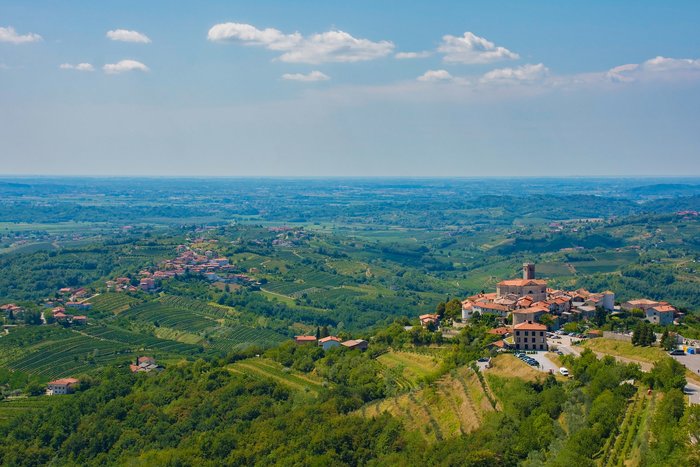
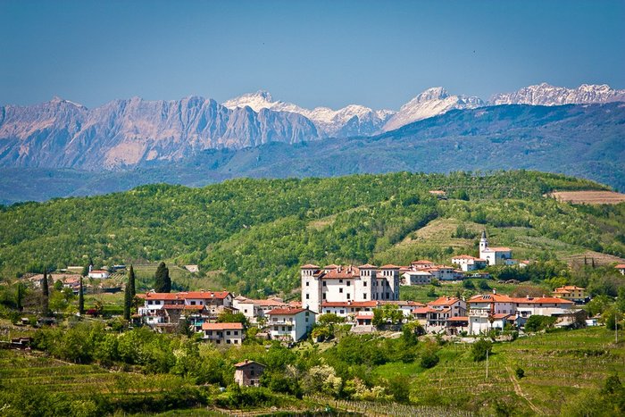
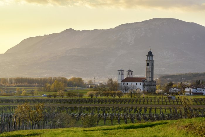
Goriška Brda, a popular section of Slovenia's Primorska Wine Region, is just 75 miles (120 km) from Ljubljana, making it easy to see both in the same trip. The fastest way to... read more
Kamnik—the base for the Kamink-Savinja Alps—is just 14 miles (22.5 km) from Ljubljana, meaning it’s quick and easy to see both in one trip. Getting between the two is most... read more
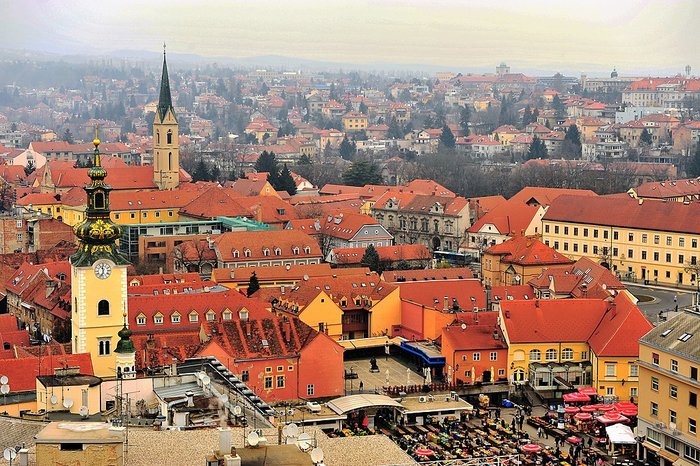
Zagreb, Croatia’s capital city, is just 72 miles (116 km) south of Maribor, making the trip between the two fairly convenient. If you’re looking for speed, your best bet is to... read more
Goriška Brda, a section of Slovenia’s western wine region, is about 75 miles (120 km) north of the seaside town of Piran. The most convenient way to travel between the two is by... read more
The town of Kobarid is just 31 miles (50 km) north of Goriška Brda, a popular section of Slovenia’s western wine region. Šmartno, an entire village designated as a cultural... read more
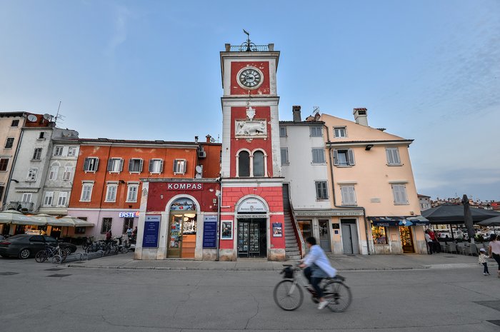
Set on Slovenia’s sliver of coastline, Piran is a popular seaside destination just 75 miles (121 km) from the country’s capital of Ljubljana. Despite its proximity to the... read more
The alpine town of Bovec is just 41 miles (66 km) from Goriška Brda, a popular section of Slovenia’s Primorska Wine Region. Šmartno, a village designated as a cultural heritage... read more
Lake Bohinj—set within scenic Triglav National Park—is 74 miles (119 km) from Logarska dolina. Because Logarska dolina is quite rural, the best way to travel between the two is... read more
The Istrian port city of Rovinj is just 128 miles (206 km) from Kobarid. Although the distance isn’t much, getting between the two can require a couple of different forms of... read more
Set on the edge of Triglav National Park, Bohinj is just 31 miles (50 km) from the rural village of Cerkno. The two are separated by country roads, and the most convenient way... read more
Istria’s coveted port city, Rovinj, is 106 miles (171 km) from Slovenia’s western wine region, Goriška Brda. This makes wine tasting and a dip in the Adriatic Sea possible... read more
Goriška Brda—a popular section of the Primorska Wine Region— is just 37 miles (60 km) from Postojna, making it easy to see both in the same trip. The most convenient way to... read more
Cerkno is only 12 miles (20 km) from the hilly, riverside town of Idrija. By car—rental or private transfer—the journey between the two is quick and straightforward. You can... read more
Set in the Vipava Valley—a popular section of Slovenia’s Primorska Wine Region— the small town of Ajdovščina is only 25 miles (40 km) from Idrija. The fastest and most... read more
Seaside Piran is just 89 miles (143 km) from the Kamnik Alps, one of the best hiking destinations in Slovenia. The fastest and most convenient way to make the journey is by... read more
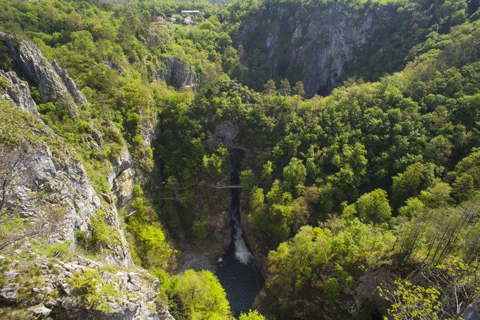
Bohinj is 96 miles (154 km) from the small, riverside town of Vremski britof, gateway to the UNESCO-listed Skocjan Caves. The fastest and most convenient way to make the journey... read more
Ajdovščina is just 23 miles (37 km) from Lokev. The fastest and most convenient way to make the trip is by rental car or private transfer, which takes just 30 minutes. This... read more
Goriška Brda is just 39 miles (63 km) from the small town of Lokev. The fastest way to complete the journey is by car—rental or private transfer—which takes only about 45... read more