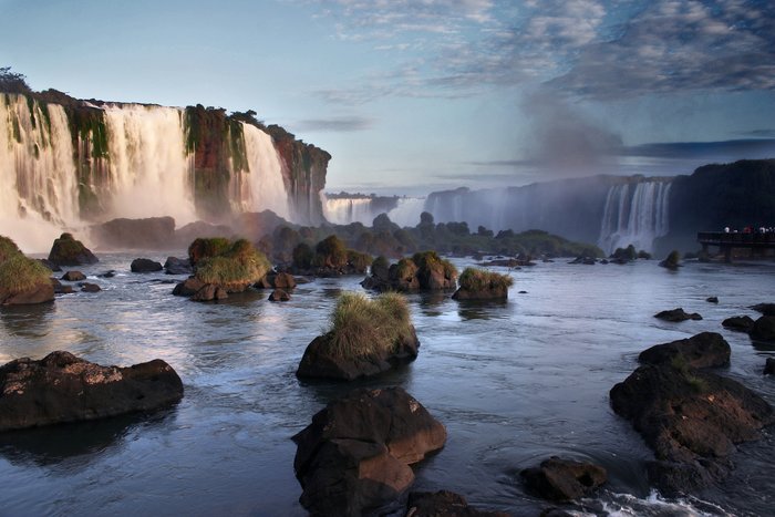
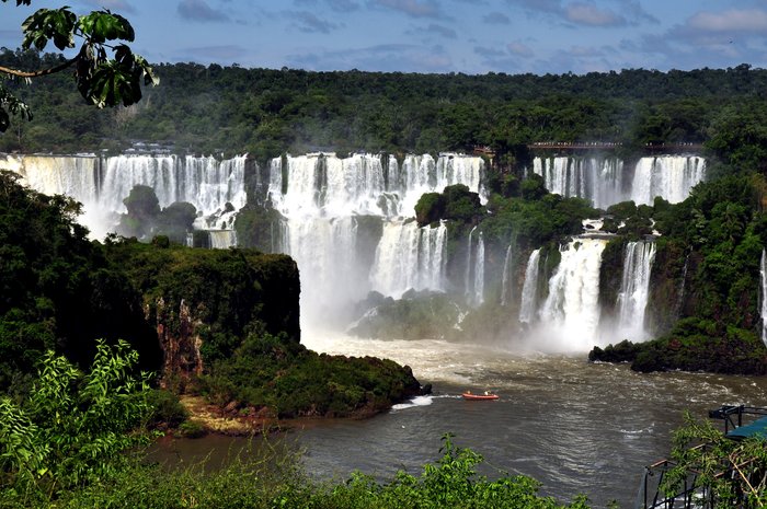
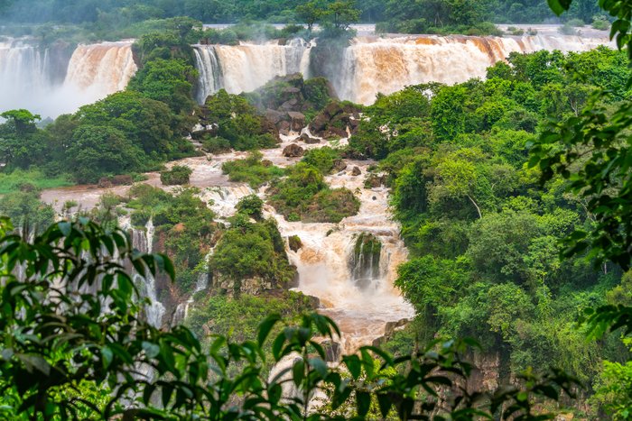
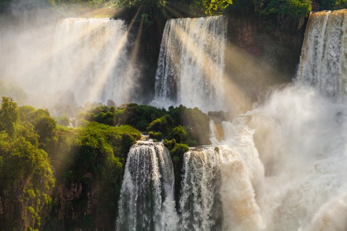
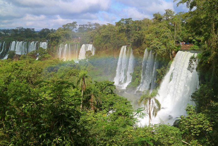
How to Get to Iguazú Falls
The Iguazú Falls are right on the border between Argentina and Brazil; if you're traveling from Buenos Aires, your best bet is to fly to the town of Iguazú and visit the falls... read more
The Iguazú Falls are right on the border between Argentina and Brazil; if you're traveling from Buenos Aires, your best bet is to fly to the town of Iguazú and visit the falls... read more
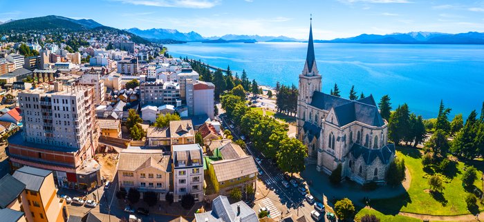
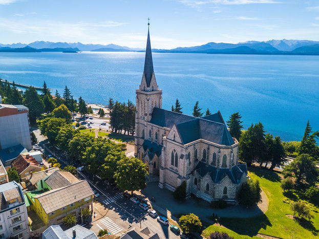
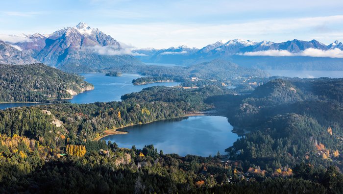
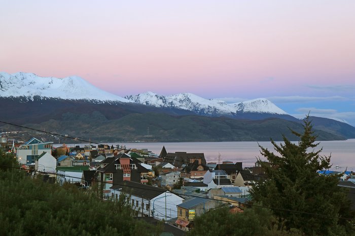
Known for its architecture reminiscent of a Swiss Alpine village and tasty chocolate, Bariloche is at the top of many visitors' lists. The easiest way to reach the city is to... read more
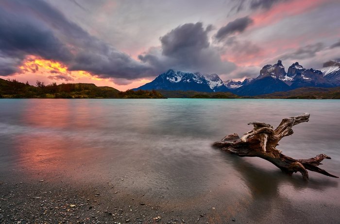
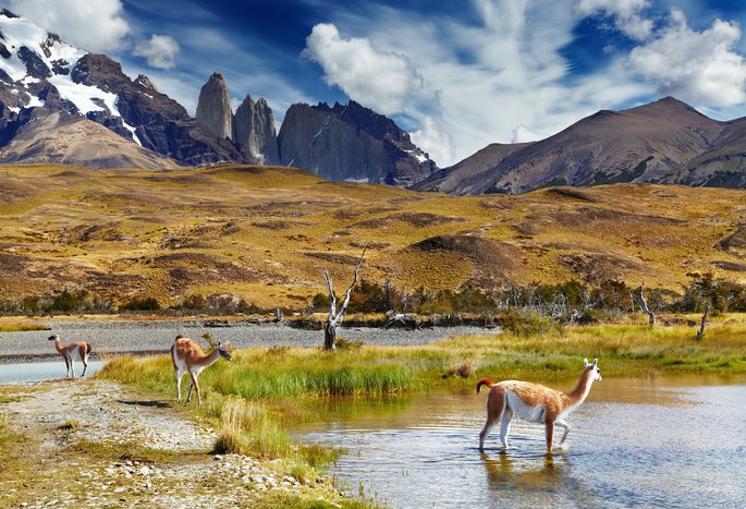
The easiest way to make the 168-mile (270 km) journey from El Calafate to Puerto Natales—gateway to the Torres del Paine National Park—is by bus. The trip takes five and a half... read more
The journey from lakeside El Calafate to the quiet mountain village of El Chaltén is easy via multiple transit options: bus, private transfer, taxi, or rental car. The most... read more
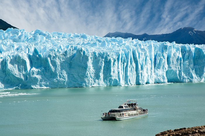
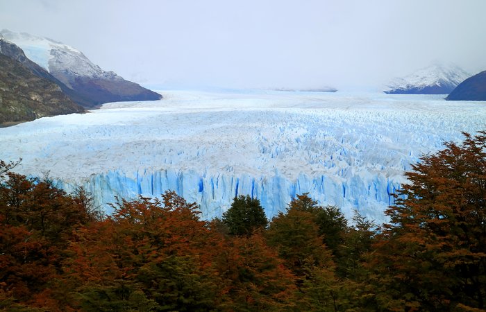
The spectacular Perito Moreno Glacier is one of the highlights of Los Glaciares National Park, in the south of Argentine Patagonia. Options to visit the glacier include taking a... read more
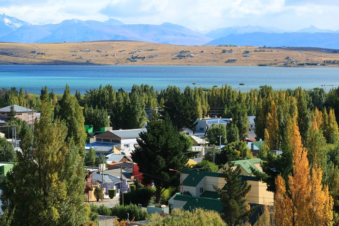
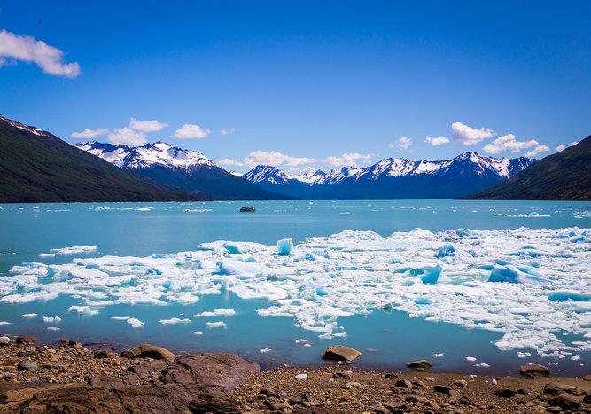
Perched on the shore of the ice-blue Lago Argentino, El Calafate is most known as the gateway to the Los Glaciares National Park and its famous Perito Moreno Glacier. Many... read more
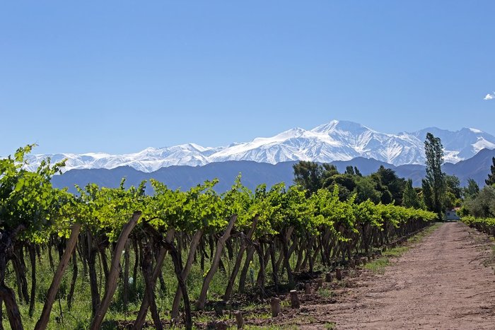
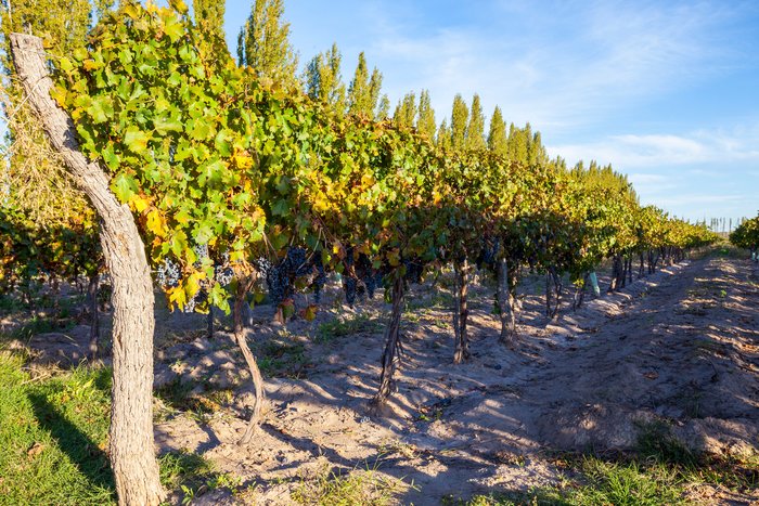
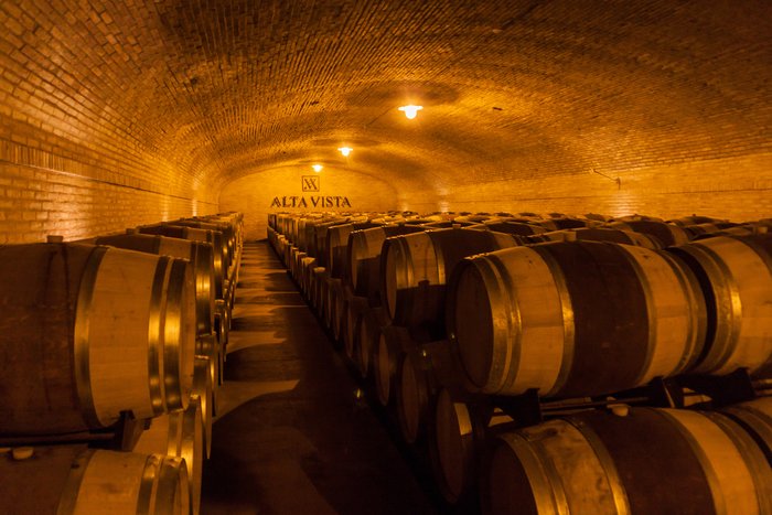
Close to the Chilean border, Mendoza is located 650 miles (1,050 km) from Buenos Aires in a region known for producing most of Argentina's wine. The easiest way to travel... read more
When it comes to traveling the 885 miles (1,425 km) between the mountain village of El Chaltén and lakeside Bariloche, you have a few options. The first and fastest is to... read more
Los Glaciares National Park is the largest national park in Argentina, and can be divided into two sections: the northern half around Viedma Lake, which includes El Chaltén,... read more
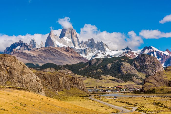
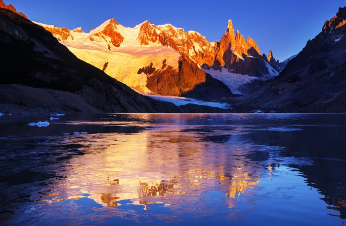
Known as one of the most spectacular destinations for hiking in Patagonia, El Chaltén practically sits in the shadow of Mount Fitz Roy and a truly spectacular section of the... read more
Traveling between El Chaltén and Puerto Natales can be tricky—even though the two towns are only 260 miles (420 km) apart—because it involves crossing the border between... read more
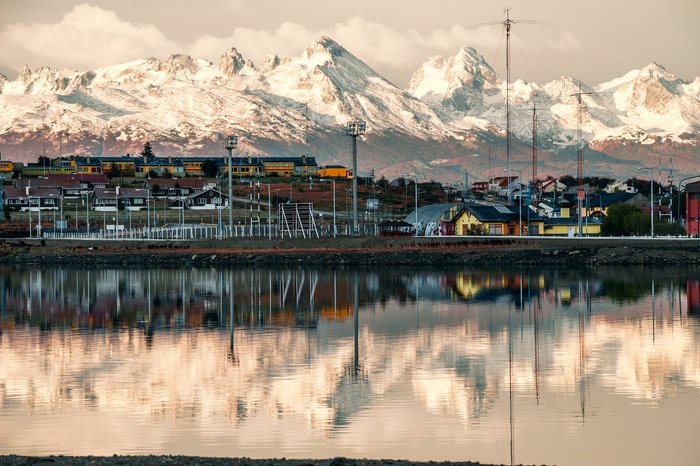
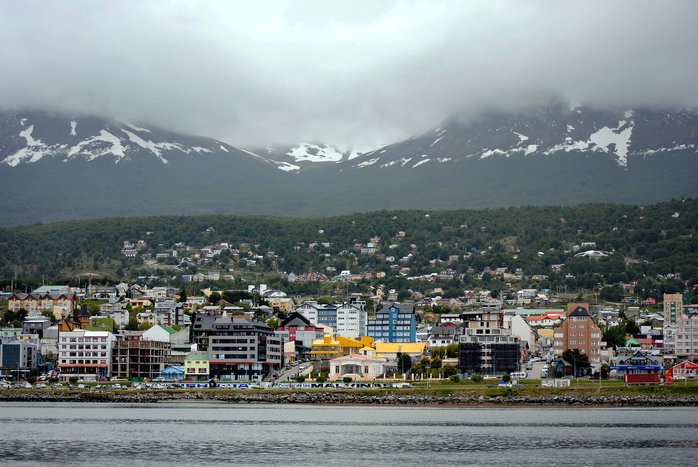
To visit Tierra del Fuego National Park, your best bet is to fly to Ushuaia and explore the area from there. There are several daily direct flights from Buenos Aires, which is... read more
Buenos Aires and El Chaltén sit on opposite ends of the country, and there are two approaches you could take to cross the 1,670 miles (2690 km) between them. To save time and... read more
Traveling from El Chaltén to Torres del Paine, which is 135 miles (217 km) south and across the border in Chile usually involves going through El Calafate, which is the... read more
Over 800 miles (1,290 km) separate Buenos Aires and San Carlos de Bariloche in Argentina’s scenic Lake District. The easiest way to travel between the two cities is by plane,... read more
Mendoza is the capital of Argentina's wine region and is close to Argentina's border with Chile. It's the perfect jumping-off point to tour the nearby vineyards and taste the... read more
Most flights from Mendoza, Argentina's wine capital, to San Carlos de Bariloche 750 miles (1,210 km) away require a layover in either Buenos Aires or Córdoba. Fortunately,... read more
Over 800 miles (1290 kilometers) separate the Argentine capital of Buenos Aires and Iguazú Falls National Park, which sits on the border separating Argentina and Brazil. By far... read more
The most direct route to cover the 1,580 miles (2,542 km) that span Mendoza and the Patagonian city of El Calafate is, surprisingly enough, through Buenos Aires. A few airlines... read more
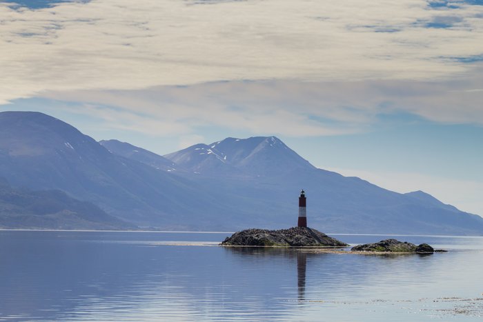
The best way to travel between Ushuaia, gateway to Tierra del Fuego National Park, and El Calafate 545 miles (877 km) away is by plane, a 1.5-hour flight. Renting a car and is... read more
There's no better starting point to get to Los Glaciares National Park than the Patagonian city of El Calafate. Sitting on the coast of the massive, turquoise Lake Argentino, El... read more
To get from Salta, a historic city in the northwest corner of Argentina, to Iguazú Falls, a mile-long system of waterfalls in the northeast corner of the country, you must... read more
The most practical way to get from Bariloche to El Calafate, 640 miles (1,030 km) away, is to book a flight. Aerolineas Argentinas operates a daily nonstop flight between the... read more
Argentine Patagonia is an enormous region that stretches from the Colorado River all the way down to the southern tip of the continent. The best way to reach Argentine Patagonia... read more
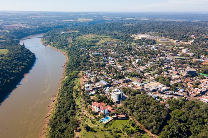
The city of Puerto Iguazú is only 12 miles away from the Iguazú National Park and its famous waterfalls. There are several ways to reach the waterfalls from the city, including... read more
Ushuaia is known for being the southernmost city in the world and is almost 2,000 miles (3,100 km) away from Buenos Aires, Argentina's capital. Fortunately, traveling between... read more
Nearly 640 miles (1,030 km) separate El Chaltén from Ushuaia, which sits at the very southern tip of Patagonia. The best way to get from El Chaltén down to Ushuaia is to loop... read more
The easiest way to travel between Mendoza, Argentina's wine capital, and Iguazú Falls almost 1,000 miles (1,600 km) away is to fly. There are no direct flights between the two... read more
Tilcara, a small, scenic city in Jujuy Province, lies about 125 miles (202 km) to the north of Salta. While many bus routes cross between the two cities, a rental car or a... read more
Both Aerolineas Argentinas and the local lowcost airline company jetSMART offer several direct flights each week between Mendoza and Salta, which is 600 miles (965 km) to the... read more
Salta is a great jumping-off point to explore Northwest Argentina and the city of Cafayate, in the Calchaquí Valley. Cafayate is 95 miles (153 km) south of Salta and is known... read more
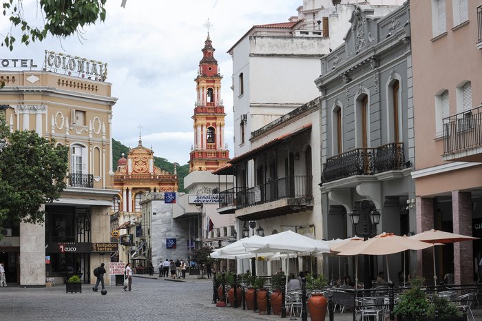
The only way to cross the 100 miles (161 km) between the capital city of Salta and the tranquil mountain town Cachi is overland, but you have a few options to choose from.... read more
The city of El Calafate, which serves as a gateway to Los Glaciares National Park and the famous Perito Moreno Glacier, is over 1,500 miles (2,400 km) from Buenos Aires.... read more
Located in northern Argentina, Cafayate is one of Argentina's main wine regions after Mendoza, and is known for producing Torrontés white wine. The two airports closest to... read more
Traveling from El Calafate, in Patagonia, up to the Iguazú Falls, which sit at the border between Argentina and Brazil, is really only possible by plane. The two cities are... read more
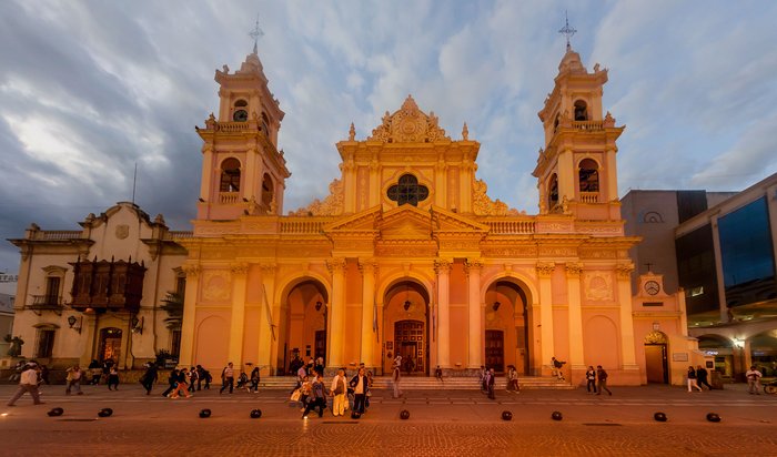
Located over 900 miles (1,450 km) away from Buenos Aires, Salta is a great starting point to explore the Northeast of Argentina, whether you decide to go south to the Calchaquí... read more
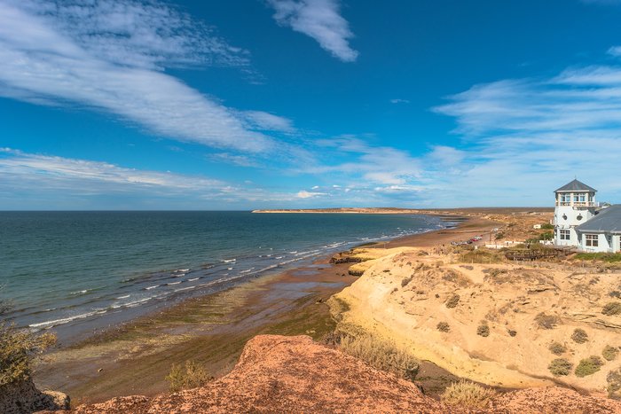
Known as Argentina's go-to destination for whale-watching and wildlife-spotting, Puerto Madryn is over 800 miles (1,200 km) away from Buenos Aires. The easiest way to travel... read more
El Calafate is a little over 625 miles (1,005 km) away from Puerto Madryn, and the easiest way to make the trip is by plane. Though Puerto Madryn is a popular wildlife... read more
Ushuaia, the southernmost city in Argentina, and Iguazú Falls, a natural landmark at the country's border with Brazil, are as far away as any two spots in Argentina can be. To... read more
Almost 800 miles (1,290 km) separate Buenos Aires and Puerto Iguazú, the Argentine city closest to the famed Iguazú Falls. Though long-distance buses between the two cities... read more
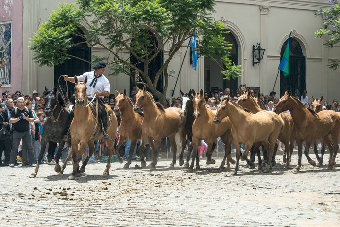
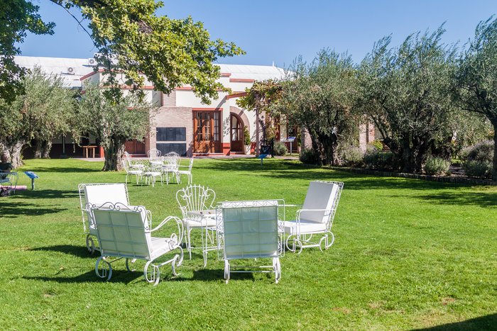
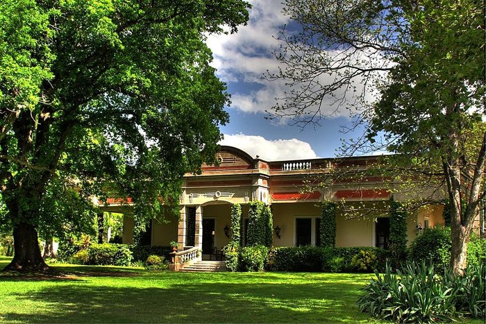
Located in the northwest of Argentina, Salta is about 850 miles (1,370 km) away from San Antonio de Areco, a small town known for its estancias (ranches) and gaucho culture.... read more
Both Mendoza and the nearby town of Chacras de Coria are famous for their restaurants and vineyards. With only 8.4 miles (13.5 km) between them, travel options between the two... read more
Patagonia is a huge region that covers the southernmost parts of Argentina and Chile. Most tourists focus on a few specific destinations within Patagonia: Bariloche and its... read more
Puerto Madryn, on Argentina's Atlantic coast, is over 1,100 miles (1,770 km) north of Ushuaia. Because the Puerto Madryn airport is very small, the easiest way to travel between... read more
The small town of Purmamarca is a little over 110 miles (180 km) north of Salta, the capital of Salta Province. Many people choose to rent a car to explore the region, but... read more
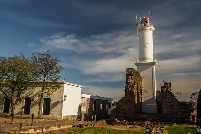
Located on the other side of the La Plata River, Colonia del Sacramento (often called simply Colonia) is only 33 miles (53 km) from Buenos Aires. Two ferry companies make the... read more
Foz do Iguaçu is the closest city to Iguazú Falls National Park on the Brazilian side. In order to visit both sides, you will need to cross the border between Argentina and... read more
Located on opposite ends of the country, El Calafate and Puerto Iguazú are 2,500 miles (4000 km) apart, pretty much as far away from each other as two cities in Argentina can... read more
Bariloche and Chacras de Coria, a small town outside of Mendoza known for its wineries, sit about 772 miles (1,220 km) apart on Argentina's western border. To get from one to... read more
San Antonio de Areco, known for its estancias (ranches) and gaucho culture, is about 1,280 miles (2,060 km) away from El Calafate in southern Patagonia. Because San Antonio is a... read more